> From the WeatherWatch archives
Updated 2:30pm — It’s a fairly settled day across the country as air pressure systems shift around a bit, easing winds and removing showers in many areas. However not all places are calm as we head towards evening – ahead of an unsettled Sunday.
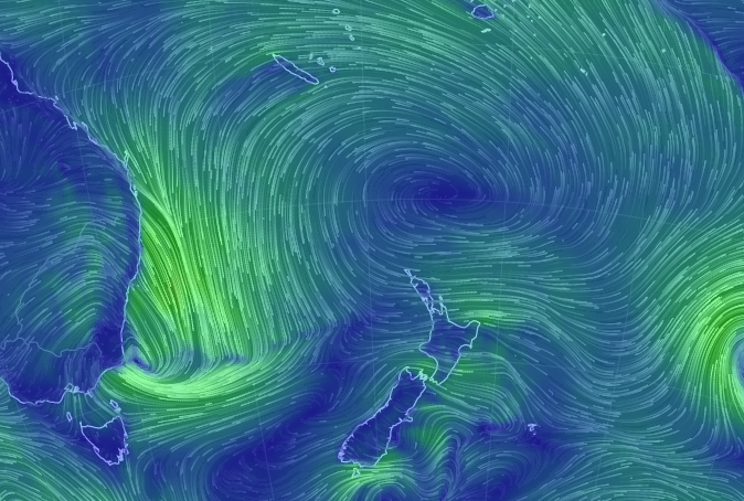
With lighter winds today not all areas may be as mild as they were yesterday – but by no means is Saturday cold, with a very powerful high sitting north of the country and gently guiding warmer than average air for September down over New Zealand.
In fact as we head into Saturday night this high north of us, along with a deepening low coming out of Sydney, will help to bring that warmer air further into New Zealand, so tonight looks milder.
Sunday looks milder too – and windier, with stronger winds in the east (might reach gale in exposed areas) and gusty winds in central areas too (upper South Island/lower North Island) with rain affecting the entire western coastline at some point in the day and it setting in for the West Coast with heavy falls.
Eastern areas will be warm and windy on Sunday – but mainly dry, although a few “spillover” spits are expected.
Sounds like a typical spring weekend!

– WeatherWatch.co.nz
Comments
Before you add a new comment, take note this story was published on 3 Sep 2016.


Add new comment