Potential for Severe Storm to approach North Island this Thurs/Fri (+6 Maps)
1/01/2018 8:28pm

> From the WeatherWatch archives
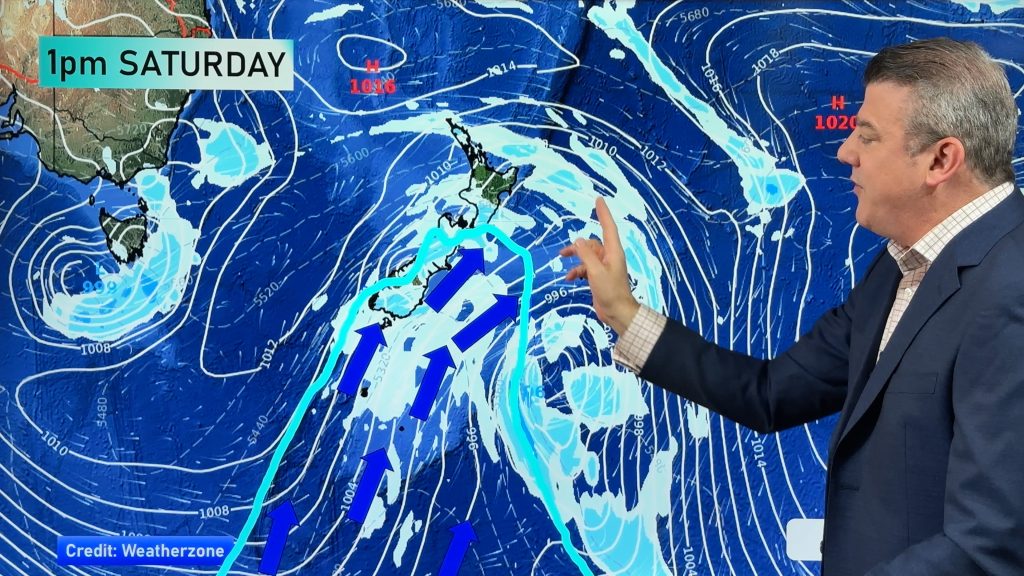
A deep low that can generate flooding rains, strong winds and dangerous beach conditions is in the forecast for the end of the week.
It’s still early days and the modelling may alter, but here’s the latest:
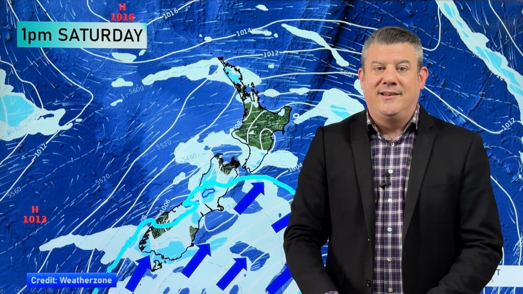
- The next three days from today are dominated by a strengthening northerly wind which supplies heat and moisture (humidity) supporting the unstable current of air.
- Afternoon thunderstorms are likely in interior regions in southern part of the North Island today and tomorrow. They spread also into the South Island tomorrow and Thursday as low-level northerly winds strengthen.
- Some thunderstorms may be severe, producing locally heavy rainfall exceeding 30mm/h, gusty winds, and possible hail.
- Following the northerly wind, a rapidly developing low pressure system will approach the North Island southeastward from the northern Tasman sea. Northland and Auckland will be exposed to strong winds over gale force at times with wind gusts on Thursday and Friday. Heavy rain is expected in those areas in Thursday during the daytime, and Bay of Plenty and Waikato in Thursday night, spilling over into Friday.
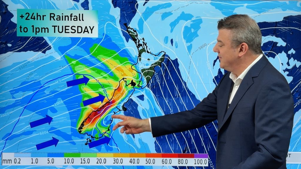
- Over the few days some areas may get over 100mm of rain.
Due to the potential rapid development of this forecast low (and always the chance it may not pan out to be quite as severe or peerhaps even worse) we advise you check back with all our forecasts and news stories over the next few days, also the latest from the various Government funded forecasters.
WeatherWatch.co.nz will have daily updates.


 Areas in darkest shade of gold are around gale force (60km/h)

JUST HOW MUCH RAIN COMPARED TO NORMAL IS COMING?
For over two months now this map has shown mostly red or pink (which means drier than average with dark red indicating almost no rain coming over the next 7 days). But this latest map shows the North Island is likely to be drenched with wetter than usual weather. Data by the US Govt showing the next 7 days of rain and which areas will be wetter than usual (blue) and drier than usual (red). Normal % of rainfall = white. As you can see the North Island may be exposed to a fair bit of wet weather.
– WeatherWatch.co.nz (An official IBM Business Partner)
Comments
Before you add a new comment, take note this story was published on 1 Jan 2018.


Add new comment
Guest on 2/01/2018 6:13am
We have just had our driest dec in 10 years and the third below average in a row we haven’t had any thunderstorms much this pass two months like others…..it takes a storm to end this madness
Reply