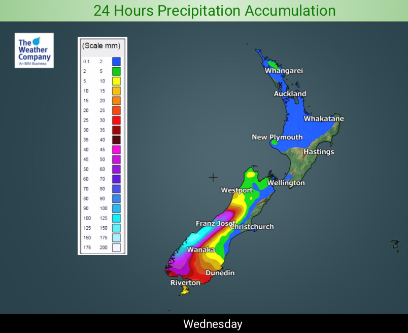
NZ’s Rainfall Maps for Wed & Thu + 5 Day Outlook for both rain & snow
8/10/2019 9:34pm

> From the WeatherWatch archives
A subtropical flow across much of New Zealand will encourage some decent rainfall totals around western and northern areas.
Next Monday we also have a low in the North Tasman Sea moving in with a burst of wind and more rain.
Heaviest rain looks to be around the West Coast (today especially) and some parts of the upper North Island.
A colder airflow over the next few days will also bring in some snow to the South Island’s mountains and ranges.


– WeatherWatch.co.nz
Comments
Before you add a new comment, take note this story was published on 8 Oct 2019.


Add new comment