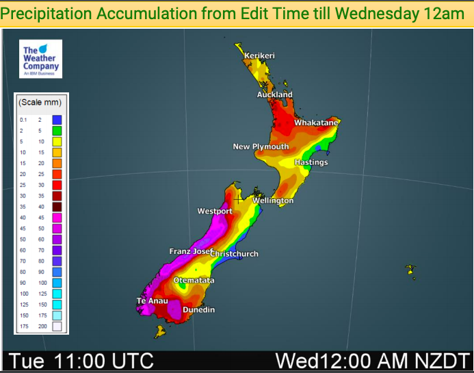
NZ: How much rain has fallen past 7 days? How much coming next few days? (+2 Maps)
3/12/2018 12:43am

> From the WeatherWatch archives
We have more rain coming to both islands but drier weather with high pressure is on the way for the end of the week and for the upcoming weekend for most regions.
The large low that was in the Tasman Sea on Saturday fell apart on Sunday and now we have the leftovers on Monday, areas of rain or showers that could turn heavy with thunder when combined with afternoon heating.
By Tuesday a cold front approaches and over Wednesday it spreads northwards dropping temperatures and bring in southerlies for some places.
High pressure grows late week – and should bring a much more settled, dry, summer-like weekend this weekend.


– WeatherWatch.co.nz
Comments
Before you add a new comment, take note this story was published on 3 Dec 2018.


Add new comment