Nationwide cool down coming, temperatures to hit ‘reset’ (+5 Maps)
13/06/2019 11:26pm

> From the WeatherWatch archives
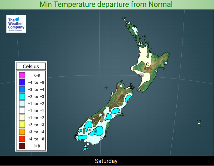
Friday is warmer than normal in just about every part of the country and while Saturday won’t be as warm for some places, it is still expected to be above average temperature-wise. However, it’s all ahead of a cooler surge coming in for Sunday across the South Island and into the lower and eastern North Island for Sunday night and across Monday.
Temperatures on Saturday night will finally drop below normal in the South Island after the warmer than usual run lately – mostly due to warmer airflows coming out of Australia or the subtropics. Now a south to south west flow from the Southern Ocean is moving in.
Early next week many regions will have ‘normal’ daytime highs for this time of year – but the nights may well be below normal as we get that cold southerly air sinking thanks to a big high coming in for Tuesday and Wednesday.
Milder weather does return around Wednesday or Thursday briefly, before the next southerly surge next weekend.
The upper North Island is least affected by this weekend’s cooler change.


– WeatherWatch.co.nz
Comments
Before you add a new comment, take note this story was published on 13 Jun 2019.


Add new comment