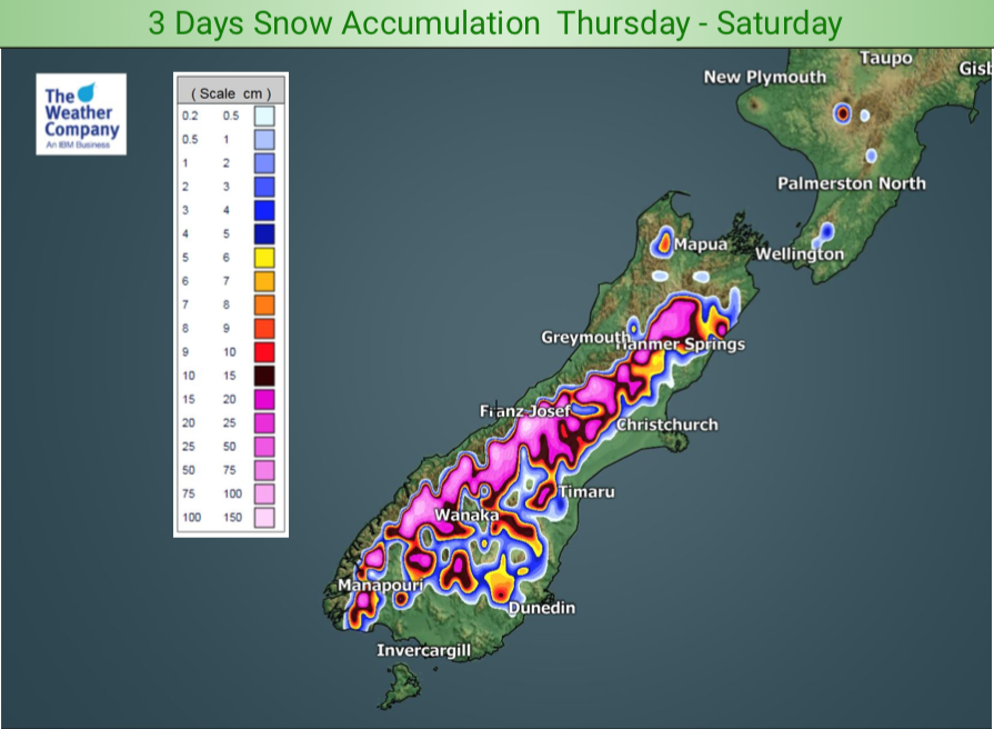
More rain and snow coming – 3 Day Accumulation Maps (x2)
14/08/2019 10:31pm

> From the WeatherWatch archives
Make the most of the dry weather today because the rain clouds are building up again. Rain returns to the West Coast on Friday and spreads into Southland later with a cold southerly.
Rain will fall as snow along the ranges and mountains, possibly as low as 200m for a time in Southland on Saturday. Rain and a cold southerly moves up the South Island across Saturday with showers and warmer westerlies for the North Island.
By Sunday high pressure expands over the South Island drying things out for most places while the North Island sees a low stuck to the north bringing rain and showers across some regions.
The maps below cover Thursday, Friday and Saturday.


– WeatherWatch.co.nz
Comments
Before you add a new comment, take note this story was published on 14 Aug 2019.


Add new comment