Monday’s national forecast – High pressure expanding, heat rising (+7 Maps)
13/12/2020 3:00pm

> From the WeatherWatch archives
High pressure is moving in from the Tasman Sea and will dominate New Zealand for most of this week.
The anticyclone will bring hot weather to the South Island with temperatures jumping today (and going even higher on Tuesday).
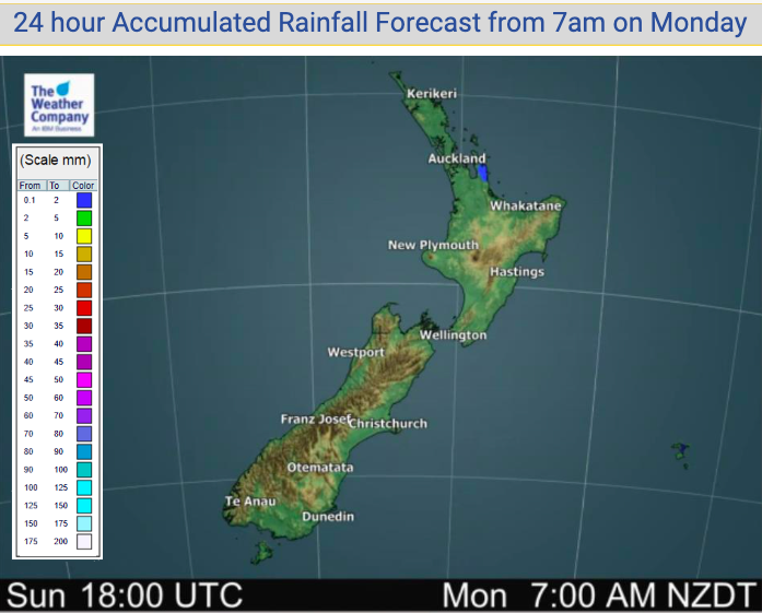
New Zealand looks entirely dry today – or perhaps one isolated light shower remaining in the fading southerly quarter flow.
To see how high temperatures will be getting in your part of NZ today, see the HOURLY details in your hyper-local WeatherWatch.co.nz forecast.


Comments
Before you add a new comment, take note this story was published on 13 Dec 2020.
Latest Video

Spring-like until Christmas (NZ’s 11 Day forecast!)
Severe gales, heavy West Coast rain, and temperature fluctuations are on the way as spring weather returns following a much…
Related Articles
Spring-like until Christmas (NZ’s 11 Day forecast!)
Severe gales, heavy West Coast rain, and temperature fluctuations are on the way as spring weather returns following a much…

NZ: Spring gales, temp drops (& spikes) + Fiji has a tropical low to monitor
We have our first forecast for Christmas Eve & Day today, but this coming week looks spring-like as a colder…

Windy westerlies return next week + Vanuatu/Fiji tropical cyclone risk update
(No video Friday, next update is on Sunday) — NZ has a cooler/colder change coming in on Friday as a…


Add new comment