Monday Newsfeed: High pressure moves in, slides off tomorrow with warmer winds for many (3 Maps)
29/09/2024 3:00pm

> From the WeatherWatch archives
This week is kicking off with high pressure covering New Zealand and it’s more northern placement allows for a nor’west wind flow to develop, increasing further on Tuesday and peaking on Wednesday
Let’s get into the forecast for Monday to begin with…
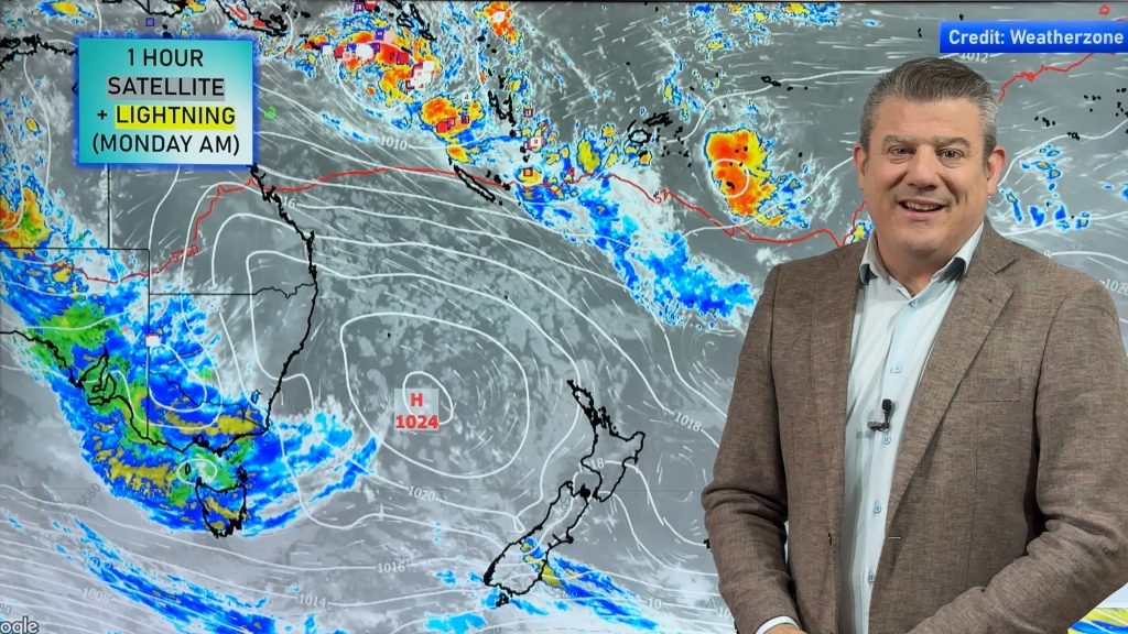
RAIN:
Today is a dry day nationwide, with perhaps a few showers in the Fiordland National Park.
WIND:
With high pressure centred over northern NZ winds are lightest in the upper North Island with a nor’wester creeping in to regions the further down the country you go, especially in the east.
TEMPERATURES:
A calm day, or those nor’westers, should see most places warm up today, especially in the east and north of NZ.
DAYS AHEAD
On Tuesday the high drifts east of the country with milder nor’westers kicking in more and strengthening. A sub-tropical or northerly airflow means many places are milder. It’s another dry day too.
By Wednesday the high moves away and low pressure starts to form behind it over the Tasman Sea. This ramps up winds to gale or even severe gale from the north to north-west, especially in eastern parts of NZ and around central NZ. Rain also moves into the west.
On Thursday a large area of low pressure forms – but your local WeatherWatch forecast will give you more details as the low has both rainy areas but large dry areas too.
And by Friday that low continues to spin over the NZ area bringing once again a mix of rainy areas and large dry spells too.
Programming Notes:
– We have no weather videos today or Tuesday – we return on Wednesday
– Our October ClimateWatch outlook is issued this Wednesday afternoon
– Our next 7 Day Australia-only video is out on Thursday (only one Aussie video this week).


As always, drill down deeper with your hyper-local, hourly, 10 day forecasts at WeatherWatch.co.nz – or download our Free WeatherWatch App.
Comments
Before you add a new comment, take note this story was published on 29 Sep 2024.
Latest Video
NZ weather: Skies will get drier before they get any wetter
High pressure is the main feature of New Zealand’s weather this week, the upcoming weekend and likely kicking off next…
Related Articles
NZ weather: Skies will get drier before they get any wetter
High pressure is the main feature of New Zealand’s weather this week, the upcoming weekend and likely kicking off next…

NZ 8 Day: High pressure to return, also monitoring tropics next week
A cooler change is moving into NZ tonight and Saturday then winds ease further on Sunday as high pressure starts…

Unsettled Thu/Fri, high pressure returns this weekend & next week
Wind and some wet weather is moving into both ends of NZ today and tomorrow bringing broken up rain bands…


Add new comment