Monday headlines (x3): NASA Balloon, Weather similar today as it was in the weekend, Low / front on Tuesday
16/04/2023 7:00pm

> From the WeatherWatch archives
Here’s what is making the weather headlines today….
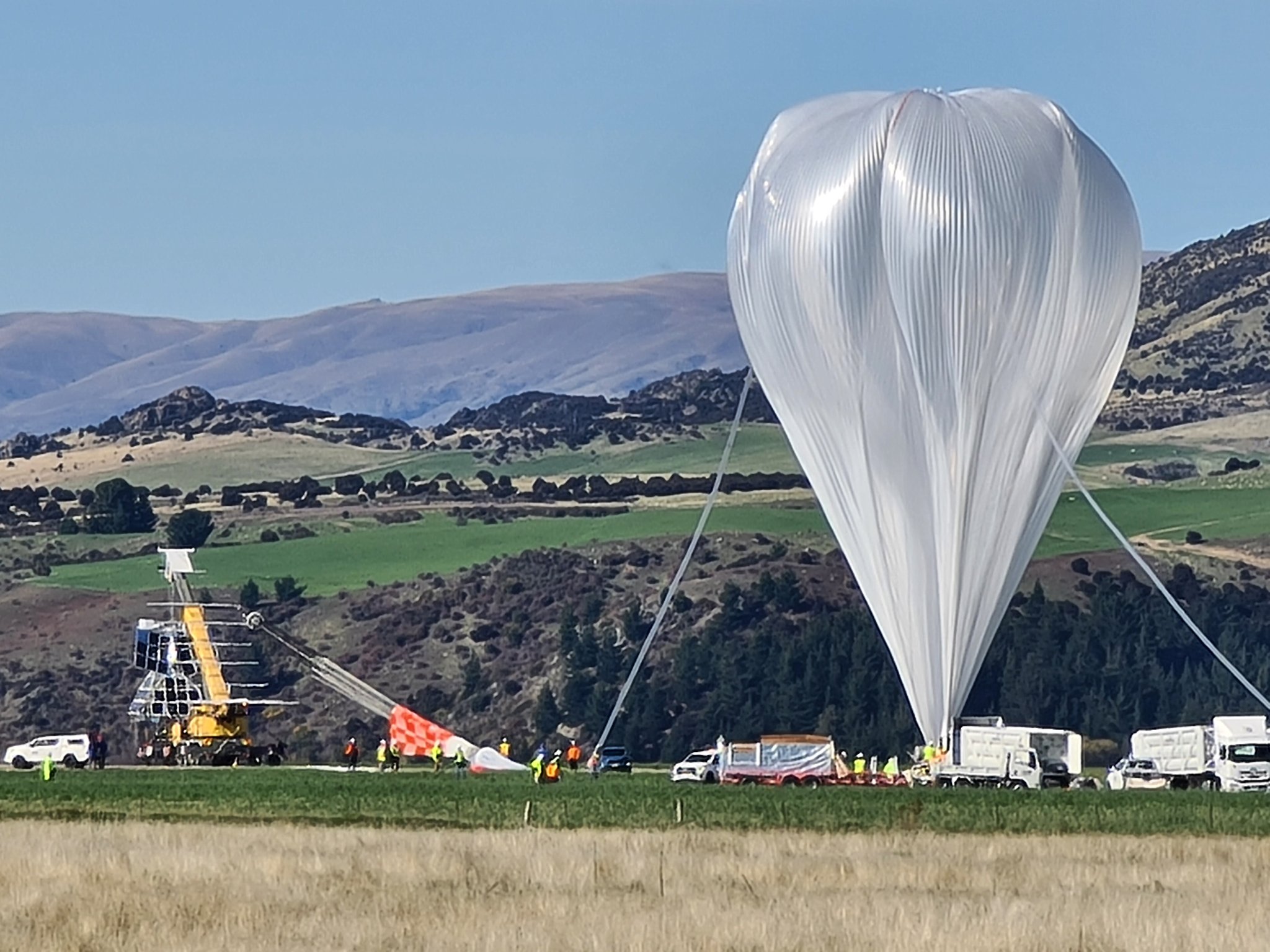
BRIGHT SPHERE IN THE SKY – NASA BALLOON
A large helium filled balloon was launched from Wanaka yesterday morning, residents in Canterbury would have noticed this in the skies yesterday evening high up in the atmosphere.
The balloon was launched by NASA and took up with it a Super Pressure Balloon Imaging Telescope, from Princeton University.
For more details on this event please head to this page here.

WEATHER SIMILAR TODAY AS IT WAS IN THE WEEKEND
A large high still sits out to our east today, this directs in an east to northeasterly airflow and brings similar weather to most parts of the country as was experienced over the weekend.
Christchurch experienced northeasterlies gusting to between 40 to 50 km/h over the weekend, winds will still get a bit gusty for Christchurch again today but not reach the weekends speeds or at least be just a tad below it.
Winds were strongest for the upper North Island, Auckland on Sunday had sustained winds reaching up to 46 km/h so gusts to gale force (62 km/h) would have been likely for coastal parts in the east. Auckland Airport recorded gusts up to 57 km/h at 1:00pm. You’ll notice in the modeled wind speeds for the upper North Island in the maps below how the winds were stronger yesterday and how they drop away a little today, still blustery though. Coastal Fiordland had very strong northeasterly winds yesterday and will again today.
The odd shower will continue for northeastern parts of the North Island (Northland through to East Cape) and the same occurs again on Tuesday.
Some nice weather would have been had in areas sheltered from the ENE airflow over the weekend, Taranaki through to Kapiti and also Central Otago / Southland, nice weather should be had in these spots again today.

Surface wind strength – Sun 16th April 2023 3:00pm – ECMWF Weatherzone.com.au 
Surface wind strength – Mon 17th April 2023 3:00pm – ECMWF Weatherzone.com.au

LOW AND RAIN HEAD IN ON TUESDAY – SOUTH ISLAND
A front forms into an area of low pressure in the Tasman Sea early on Tuesday then moves towards the South Island, this brings rain to the West Coast and there could be a few heavy falls before easing from the south later in the day.
The lower South Island may see rain or showers for a time also but it is a little dependent on the exact movement of a front moving over. Canterbury should see some scattered rain, into the second half of the day seems more likely then finally Nelson and Marlborough could see heavy rain overnight.
Metservice have started the process of issuing a few watch’s regarding this incoming rain and they may be upgraded to warnings. More here.
Another round of heavy rain is possible for some western regions later in the week so that will be something to keep an eye on also.

Comments
Before you add a new comment, take note this story was published on 16 Apr 2023.


Add new comment