Low pressure over NZ likely to weaken Cyclone Ruby – but also boost NZ’s rainfall (+6 Maps)
12/12/2021 1:18am

> From the WeatherWatch archives
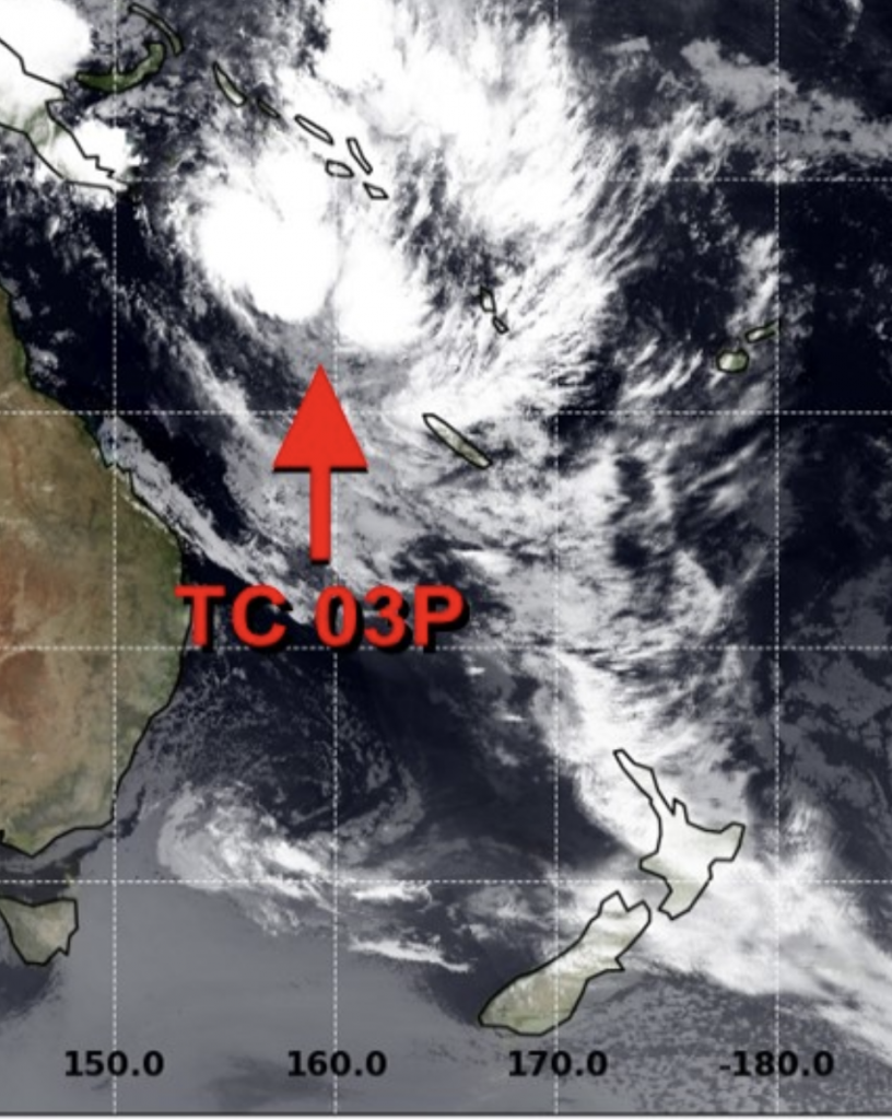
We have a complicated set up this week. A tropical cyclone exiting the tropics will link arms with a larger but weaker low over New Zealand.
The result? The low over NZ will ‘suck’ wind energy out of the tropical cyclone, likely weakening the cyclone faster and limiting just how powerful it gets, but helping to produce even more rain in New Zealand.
The storm originally had the potential to reach Severe Category 3 status, and for a time the modelling even showed it briefly reaching the maximum Category 5…that was, however, until the low pressure zone over NZ became more locked in for the coming week.
When you place a normal low pressure zone near a Tropical Cyclone the two often merge – transferring wind energy in a more even manner, which far reduces the peak wind speeds and overall power of the tropical storm, but it can significantly increase the risks of widespread tropical rain further afield.
The modelling we trust most shows this happening – the cyclone leaving Vanuatu and New Caledonia area on Tuesday/Wednesday while a low in the upper part of New Zealand helps deflate the wind speeds there even further and shrink the size of the cyclone. But this process may then help give more fuel to the low over NZ – encouraging more rain and blustery nor’easters.
“To be honest, this is the result many people in NZ were looking for. The dry upper North Island looks set to get some significant rain but hopefully without the major wind issues we see with a tropical cyclone” says WeatherWatch.co.nz head forecaster Philip Duncan.
“The upper North Island has been in a rainfall deficit for nearly four years now, so this rain will be welcome so long as it’s not too intense in areas that are more prone to flooding, such as the Coromandel Peninsula for example”.
The latest tracking shows New Caledonia and the southern islands of Vanuatu taking a direct hit – or near hit – as Tropical Cyclone “Ruby” (named Sunday afternoon by Australian forecasters) passes by in the coming days. Category 2 power is most likely (with gusts to 160km/h), but Category 3 (which is technically the “severe” status) is still possible. The other low in the NZ area may help reduce the size and power of the cyclone, but it will remain one to closely watch in case it does still clip NZ. WeatherWatch.co.nz will have more details on Monday for NZ’s risks.
Duncan says “In a nut shell, this week coming up will be warm, humid, wet and cloudy for the North Island and upper South Island. Classic La Nina set up with the risk of torrential falls in some North Island regions”.
Long range data suggests a drier trend returns before Christmas and for late December. We’ll confirm this in the coming days.


- WeatherWatch.co.nz
Comments
Before you add a new comment, take note this story was published on 12 Dec 2021.


Add new comment