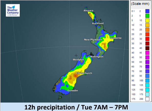
Large low to form over the North Island next 24 hours, heavy rain for some (+5 Maps)
6/03/2018 5:02am

> From the WeatherWatch archives
A front currently lying across the Tasman sea will move northward and form a new low pressure system near
Northland on Wednesday morning. This developing low is today creating for very calm, humid, conditions in the north and this has lead to fog affecting flights at both Hamilton and Auckland domestic airports this morning.
Today this fog will convert to afternoon cloud build ups with a few downpours forming inland in the upper North Island.
In the South Island a colder change is moving northwards with showers.
Some thunderstorms are likely in Canterbury, Marlborough, and eastern and northern parts of the North Island on Tuesday.
Despite some of the big forecasts for heavy rain and isolated thunderstorms in some regions this set up with a large but weak low will see breaks in the cloud allowing for sunny areas and dry or drizzly spells for others in the North Island.
Other highlights:
- Wednesday and Thursday see areas of rain, showers and isolated thunderstorms in the North Island.
- On Wednesday Severe Thunderstorms are possible in some parts of the upper North Island and this area will spread into Bay of Plenty, Gisborne, and Hawke’s Bay on Thursday.
- Specifically in Hawke’s Bay rain accumulation beyond Thursday could be concerning, due to the persisten easterly wind.
- From Saturday, there is a risk of enhanced rain and wind in the North Island due to a tropical cyclone which is now emerging near Vanuatu. Though the exact timing and location of the arrival is largely uncertain at this moment.


– WeatherWatch.co.nz, an IBM and Weather Company business partner
Comments
Before you add a new comment, take note this story was published on 6 Mar 2018.


Add new comment