> From the WeatherWatch archives
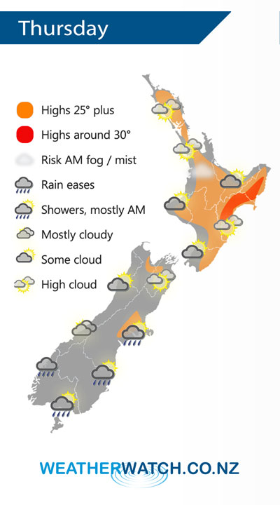
Mainly anticyclonic for New Zealand on Thursday, a weakening front moves northwards over the South Island during the day.
Mostly sunny with high cloud for the North Island on Thursday, some mid level cloud in the morning breaks away. May even be a morning mist or fog patch first thing for some inland spots then breaking away.
Dry with a mix of sun and cloud for the upper South Island. Rain about Fiordland eases to showers then clearing in the evening. A few showers about Southland and Otago, mostly morning but a chance one or two may linger into the afternoon. A morning shower for Canterbury Banks Peninsula southwards then clearing, overnight drizzle or a few showers move in for most of Canterbury.

By Weather Analyst Aaron Wilkinson – WeatherWatch.co.nz
Comments
Before you add a new comment, take note this story was published on 12 Feb 2020.


Add new comment