> From the WeatherWatch archives
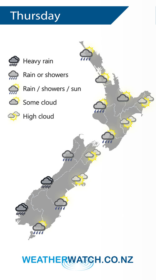
A westerly quarter airflow lies over New Zealand on Thursday, a cold southwest change hits the lower South Island in the morning moving northwards to reach the lower North Island overnight.
The odd shower continues at times for the western North Island on Thursday, expect plenty of long dry spells. Dry in the east.
Heavy rain moves into Fiordland in the morning reaching North Westland in the afternoon, easing overnight. Rain pushes into Southland late morning reaching Otago in the afternoon and Canterbury in the evening with a fresh southwest change. Overnight rain may become heavy about North Canterbury.

By Weather Analyst Aaron Wilkinson – WeatherWatch.co.nz
Comments
Before you add a new comment, take note this story was published on 25 Mar 2020.


Add new comment