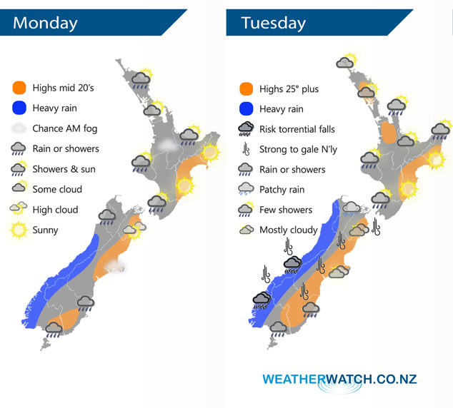
InfoGraphic: The Big Picture for Monday / Tuesday
24/03/2019 6:00pm

> From the WeatherWatch archives
A northerly airflow lies over New Zealand today with a large anticyclone off to the east in the Pacific Ocean. This northerly strengthens on Tuesday, a front moves onto the lower South Island in the afternoon then slowly moves northwards.
Areas of cloud and the odd shower for the upper and western North Island today, there may even be a fog patch this morning about the Waikato. Mainly sunny conditions along the east coast. Areas of rain or showers for the West Coast of the South Island, rain heavy at times south of about Greymouth. Rain spills into Southland and Otago at times, especially this morning. Any morning fog about Canterbury clears away.
Mainly dry for the North Island on Tuesday, a shower or two possible about some extremities. The east coast once again is mainly sunny. Heavy rain for the West Coast of the South Island, torrential falls possible especially south of Greymouth. Mainly dry in the east with thick high cloud, rain moves into Southland around midday then pushes into Otago during the afternoon. Northerly winds will be a bit blustery especially about the alps where winds may gust to gale at times.

By Weather Anlayst Aaron Wilkinson – WeatherWatch.co.nz
Comments
Before you add a new comment, take note this story was published on 24 Mar 2019.


Add new comment