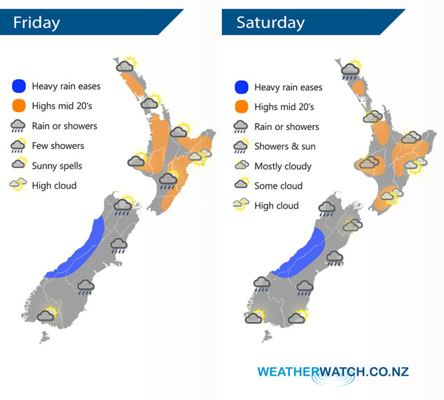
InfoGraphic: The Big Picture for Friday / Saturday
14/03/2019 6:00pm

> From the WeatherWatch archives
The flow tends northeast today with a warm front bringing rain to the South Island, heavy falls possible in the west. This front sticks around the South Island on Saturday, mainly settled further north.
Mainly dry for most of the North Island today, chance of a shower in the afternoon / evening about Wairarapa otherwise mainly dry. May also be a light morning shower or two for Bay Of Plenty. The South Island is mostly cloudy with areas of rain or showers, heavy at times in the west. Rain eases from afternoon in the east. There may be some fog to start the day for Southland.
The North Island is mainly dry on Saturday, expect plenty of cloud however with only occasional areas of sun. A morning shower or two may clip Northland. The South Island sees wetter conditions, rain may be heavy in the west again then easing from afternoon. A mix of sun and cloud for Southland.

By Weather Analyst Aaron Wilkinson – WeatherWatch.co.nz
Comments
Before you add a new comment, take note this story was published on 14 Mar 2019.


Add new comment