> From the WeatherWatch archives
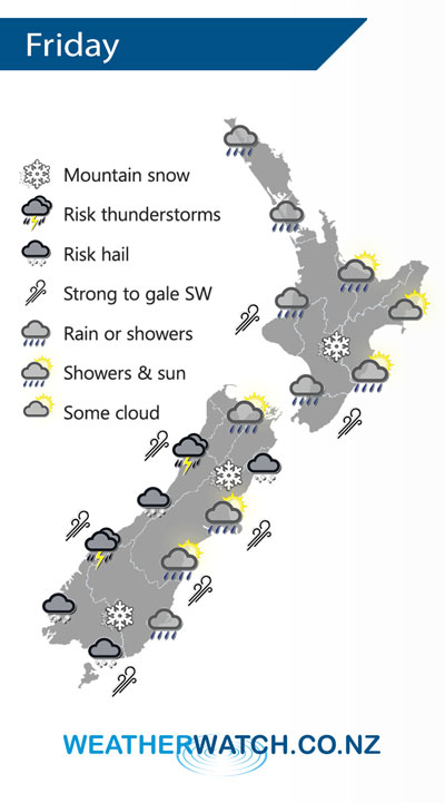
A low pressure system south of New Zealand flicks a cold front and associated very cold air over New Zealand on Friday.
Showers for the western North Island on Friday, picking up in intensity from afternoon, blustery west to southwesterly winds. The east coast is mainly dry with some high cloud, in the afternoon a few spots of rain may spread from the west. Wellington has a dry morning, afternoon showers then dry again evening, strong to gale WNW winds.
Rain with heavy falls and possible thunderstorms / hail along the West Coast, easing in the evening. Snow in the ranges to 500m. Nelson sees showers at times from midday, Marlborough is mostly sunny, blustery westerlies. Sunny areas for Canterbury with northwesterly winds, tending southwest in the evening near the coast, the odd shower possible about Banks Peninsula then overnight showers pick up for coastal areas. Showers or spots of rain about the far south turning to rain in the afternoon as northwesterlies change strong to gale southwest. Rain may be heavy then easing overnight, snow to 500m.

By Weather Analyst Aaron Wilkinson – WeatherWatch.co.nz
Comments
Before you add a new comment, take note this story was published on 1 Aug 2019.


Add new comment