ExCyclone Gretel skirting NZ to the east, some gales today (+5 Maps)
16/03/2020 7:18pm

> From the WeatherWatch archives
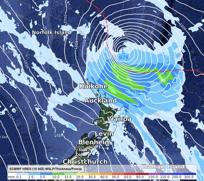
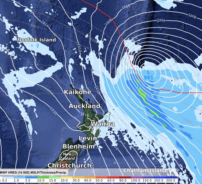
Gretel is now an ex-cyclone but still has damaging winds around part of it as it slides down the eastern side of the upper North Island.
Some rain has affected the Far North and eastern Northland overnight but not enough to penetrate to western Northland or into Auckland or Waikato.
Today the storm will track down the east bringing gales over 100km/h to the ranges around Gisborne and East Cape and while fairly isolated those in the area may have possible power cuts.
Blustery winds and coastal gales will affect a few North Island places today but damage isn’t expected.
Conditions ease quickly on Wednesday.
THE MAPS:
Air Pressure & Rain Map as of 9am Tuesday

Air Pressure & Rain Map as of 9pm Tuesday:


WeatherWatch.co.nz
Comments
Before you add a new comment, take note this story was published on 16 Mar 2020.


Add new comment