ClimateWatch: NOVEMBER’s outlook as high pressure lifts in NZ, low pressure grows in Oz.
31/10/2025 1:55am
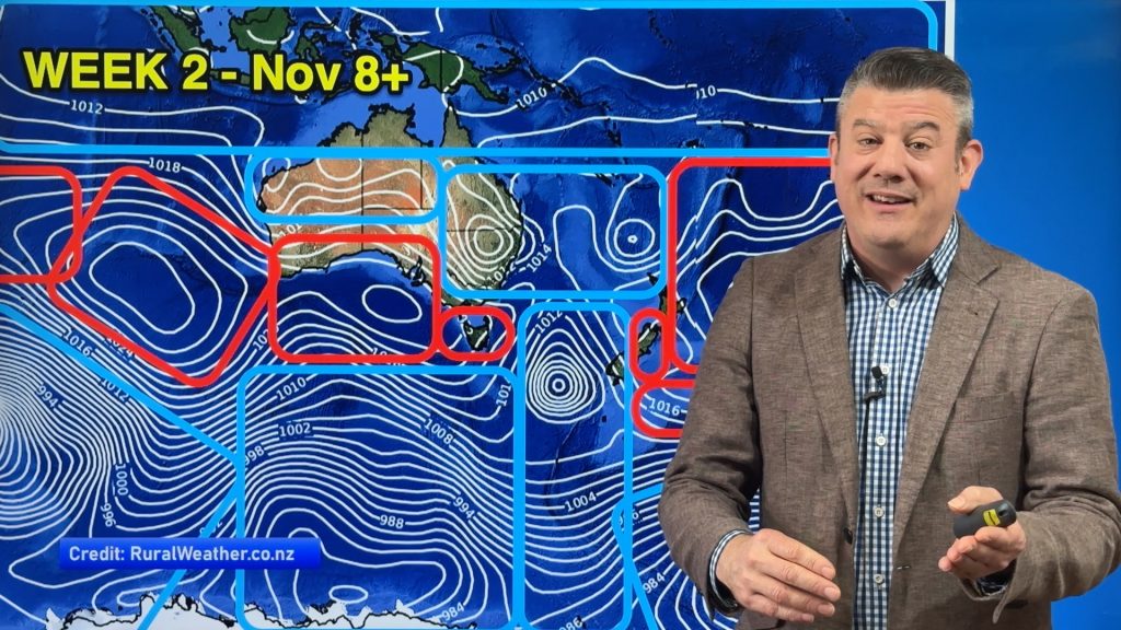
In our monthly “ClimateWatch” forecast the first week of November in NZ looks settled and mostly dry, while Australia and the subtropics see more low pressure zones producing rain, showers and thunderstorms.
One of the main takeaways from our latest monthly outlook is seeing how the worst of spring’s winds look to shift further southwards out of NZ and Australia – and not so much smack bang over us. This is usually what happens in November and can fast see some regions drying out over the weeks ahead. It doesn’t mean it’s all over – but there should be much longer stretches of calmer weather coming into the mix.
But storms are still south of our nations and over Australia and the Tasman Sea area during the coming weeks – and Australia’s southern coastline looks more exposed than NZ does (at least for the first half of the month) as far as Southern Ocean storms are concerned. This means more temperature fluctuations and cold fronts, especially in November’s first week for Australia.
In the tropics La Nina continues to try to form – we discuss that and even if it does form it looks short lived and what that might mean.
Meanwhile west of Australia the negative IOD continues over the Indian Ocean – for now anyway.
South of our nations SAM (Southern Annular Mode) returns to NEUTRAL over the coming couple of weeks… that usually means windier westerlies get pushed further southwards over the Southern Ocean giving both Australia and NZ some break in the windy weather so far this season.
We have 15 day rainfall maps for New Zealand, Australia and the South Pacific and the latest on sea surface temperatures and marine heatwaves.
Our next ClimateWatch monthly update will be on Monday December 1st.
Comments
Latest Video

NZ Easter Weather Update + monitoring the tropics for storm potential
High pressure smothers New Zealand as we head into the long weekend bringing mostly dry weather and light winds, with…
Related Articles
NZ Easter Weather Update + monitoring the tropics for storm potential
High pressure smothers New Zealand as we head into the long weekend bringing mostly dry weather and light winds, with…

ClimateWatch: APRIL’s outlook as La Niña ends, shift to NEUTRAL
La Niña is officially over and now we’re in a “neutral” period of weather for the month of April, which usually…

NZ & South Pacific: Big Picture forecast for Easter + cyclone potential in tropics
Today’s video is a “Big Picture” one covering New Zealand and the south-west Pacific through to Wednesday of next week,…


Add new comment