Easter Weekend: Unsettled weather with sun & calm, then gales and rain (+5 Maps)
9/04/2020 2:33am

> From the WeatherWatch archives
Stormy weather this weekend has been hard to nail down but severe risks are now becoming clearer.
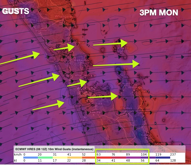
A large area of low pressure will form in the New Zealand area and may now cross central parts of the country. The models this week, from all sources, have been sure of a large low in the NZ area but have not been sure about precisely where it would be.
Today it’s starting to become clearer how things might shape up and where severe weather might push through.
Easter Monday perhaps looks stormiest for most with wintry conditions building in south.
We have just RELAUNCHED www.RuralWeather.co.nz – it’s now lightning fast, saves locations properly and has no slow loading times. Please check it out to fine tune this stormy weather and what it means for you. It has graphs, trends, hourly data for 10 days out – in fact the most weather data on earth for NZ is available for free right now at www.RuralWeather.co.nz
TO SUM UP:
The weekend is a typical Easter Weekend in New Zealand with some pleasant outside weather to mow the lawns, do some gardening, hang out the washing or simply get separation from those you are self isolating with – along with stormy weather which will likely keep you inside, especially around Sunday and Monday.
Severe weather warnings will likely be issued by MetService this weekend.
New Zealanders should also be prepared for power cuts and loss of internet or phone services – even if mentally preparing for it more than anything else due to the Covid-19 lockdown.


- WeatherWatch.co.nz – For news, maps and video
- RuralWeather.co.nz – For the most localised weather data on earth for NZ
Comments
Before you add a new comment, take note this story was published on 9 Apr 2020.


Add new comment