> From the WeatherWatch archives
The big high rolling in to New Zealand is complicated and will also be oddly dragging with it some sinking low pressure which when combined with daytime heating will create big afternoon downpours inland and around the ranges.
These downpours look to be every day for the next several days, if not longer.
WeatherWatch.co.nz says the slow movement of these downpours means flash flooding risks will be increased and farmers in rural inland areas should be aware of the risks – especially in the North Island.
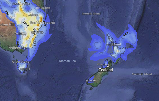
The downpours do move around a bit each day but the central and north eastern North Island look most exposed and may end up having a wetter than average week. At the other end of the scale, Southland looks to have a drier than average week ahead which will be welcome news following recent thunderstorms and flooding.

– Image / Thursday afternoon Thunderstorm risks
– WeatherWatch.co.nz
Comments
Before you add a new comment, take note this story was published on 10 Dec 2018.


Add new comment