> From the WeatherWatch archives
Severe tropical cyclone Evan is this morning slamming into Fiji with hurricane force winds, torrential rain and wild seas.
WeatherWatch.co.nz says the centre of Evan now lies almost over the northern island of Vanua Levu.
Head weather analyst Philip Duncan says the powerful cyclone is just offshore but that means the worst of the winds – which wrap around the centre – are now roaring across populated places. “This deadly tropical cyclone will be catastrophic for some communities and low lying islands. This is about as serious as it gets”.
Evan is producing sustained winds of around 170km/h with gusts to 230km/h. However the damaging gales extend for 220kms from the centre “This means damaging wind gusts can and most likely will affect almost all of Fiji today”.
“The centre of this cyclone is right now slamming into northern Fiji and over the next 12 to 24 hours will push very slowly across the rest of Fiji including Nadi”.
 This map shows exactly where Evan is located, just north west of Vanua Levu and now heading into the main island of Fiji.
The brown and purple indicate severely damaging hurricane force winds.
Image as of 7am Monday morning courtesy of weathermap.co.nz
Evan is tracking west south west which will take him closer to Nadi later today and into Tuesday.
“Evan is a very slow moving cyclone which greatly increases the risks of flooding and landslides. It also means relentless damaging waves which in some cases will be putting low lying islands entirely underwater right now” says Mr Duncan.
Evan could cause significant damage to island resorts in the Yasawa islands north west of Nadi where hurricane force winds coupled with a large storm surge could inundate some resorts and communities.

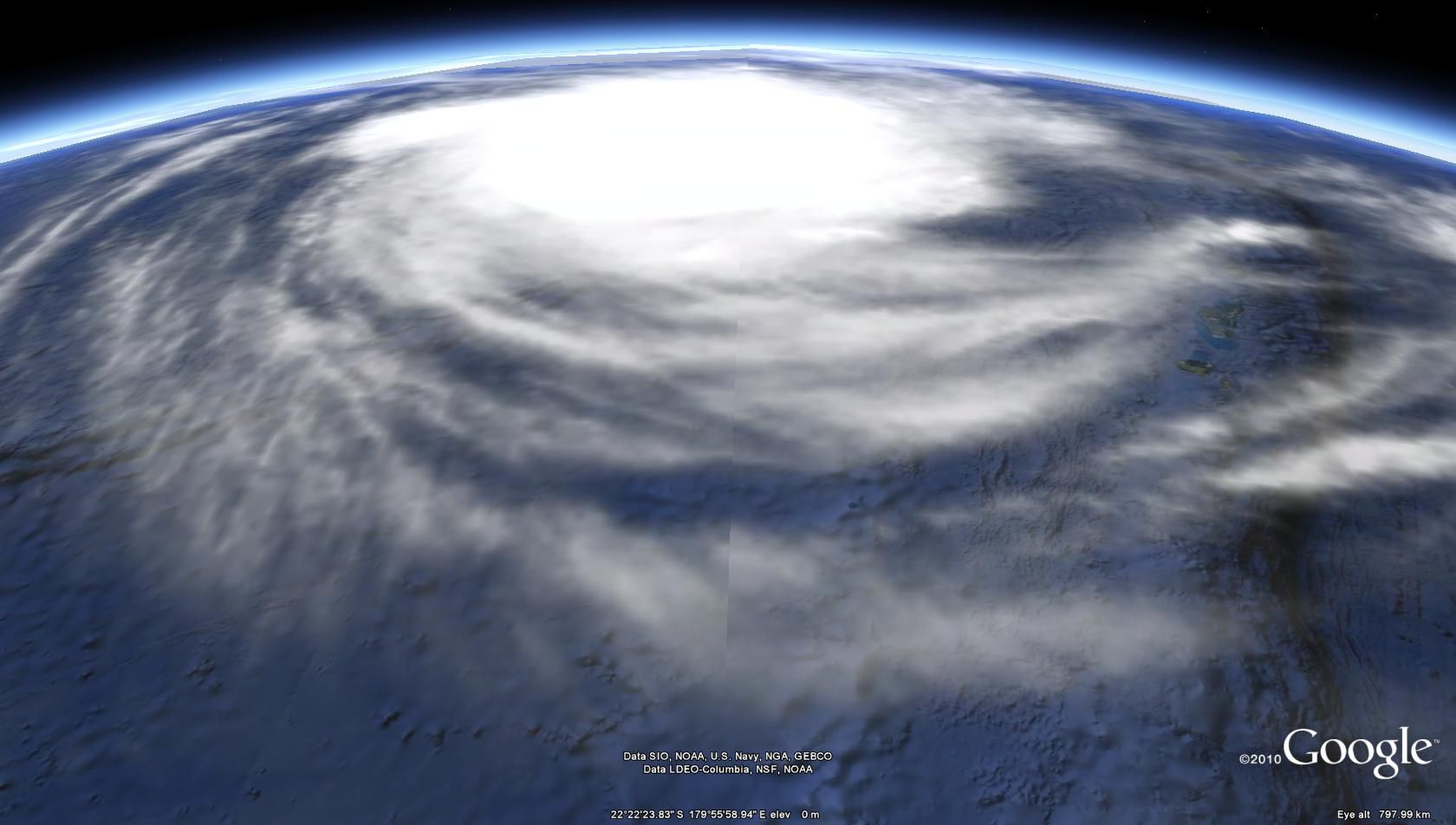
How Evan looked from space, Monday Morning / Google Earth
Evan and New Zealand
WeatherWatch.co.nz forecasters say a week ago they gave a 20% chance of Evan reaching New Zealand, this morning Philip Duncan places that risk at around 60% as computer models for the second day in a row agree the most likely course for Cyclone Evan is towards the upper North Island – and some models have been picking this for a week now.
“We believe this tropical storm will drop south towards Northland, Auckland, Coromandel Peninsula, Waikato, Bay of Plenty and East Cape this coming weekend. In what shape or form is yet to be worked out but even as an ex-tropical cyclone Evan could still bringing flooding rains and damaging wind gusts”.
Mr Duncan says with so many people about to head away for Christmas it was important to get the message out. “We aren’t going to be hit in the same way as Fiji is, but we can’t rule out a day or two of severe weather for some parts of New Zealand this coming weekend as Evan likely moves down our way”.
WeatherWatch.co.nz says the models show Evan will be weakening before he reaches New Zealand and will most likely fizzle out around the nation. “Cyclone predictions for New Zealand are always very hard – look how narrow the top of New Zealand is – these storms can slide down either side like an egg on a roof”.
Mr Duncan says people don’t need to panic, but should just monitor the weather forecasts and latest weather news as cyclones and ex-cyclones can be fairly unpredictable.
Evan is helping to complicate the Christmas Day forecast for New Zealand. “If Evan wasn’t in the picture I’d say Christmas Day will be settled for 90% of the country. Now we have a bit of a wild card”.
WeatherWatch.co.nz has been updating New Zealanders on Evan’s potential track for over a week now – and will continue updates each day this week.
Check out our current Christmas Day forecast here
The latest threat map from Fiji Met:

Comments
Before you add a new comment, take note this story was published on 16 Dec 2012.


Add new comment
Chris on 17/12/2012 1:12am
Yeah !!! I’m having a 70th birthday party on Saturday up here in the Bay of Islands. Could be soup, soup and more soup… Meant to be a BBQ.
Great Stuff.
Reply
Dave on 16/12/2012 9:40pm
Thanks for the update. It sure doesn’t look great for Fiji at the moment.
The way the highs are set up here at the moment I am sure we will be getting a visit from Evan, it is really just a case of east coast or west coast of Northland.
On the positive side I guess it is much better to have this prior to Xmas than after when so many people will be taking a break. Hopefully he picks up speed on his way south
Cheers
Dave
Reply