> From the WeatherWatch archives
Tropical Cyclone Bune remains a Category 3 status cyclone this afternoon with winds averaging around 120km/h.
It is expected to very slowly weaken into a Category 2 cyclone on Monday with sustained winds around 110km/h.
Latest satellite maps show the eye coming apart as the storm heads further south.
Fiji Met Service forecast charts show the remains of Bune pushing closer to East Cape and Gisborne on Wednesday and Thursday.

Latest situation and tracking – this image is live and updates automatically – Fiji Meteorological Service
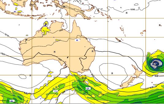
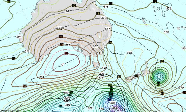
The models now place cyclone Bune directly over the top of Raoul Island by midnight Monday as a Category 2 storm.
Raoul Island is home to several Department of Conservation staff with up to 10 potentially on the island reports NZPA.
A category 2 cyclone could fell trees, damage some buildings and sink boats.
The storm is expected to curve back in towards New Zealand but, as predicted all week, the centre is not going to make landfall here. There is still a possibility of severe weather affecting Gisborne and East Cape but confidence remains low by WeatherWatch.co.nz forecasters.
High confidence remains, however, for dangerous rips and surfs along the east coast, especially between the tip of East cape and Wairarapa between Tuesday and Saturday of next week.
The cyclone almost stalled Saturday, moving at less than walking speed.
Today it is moving at walking speed, around 8km/h.
The central air pressure is 973hPa.

Long range model for midnight Tuesday / ECMWF

Long range model for midnight Wednesday / GrADS COLA/IGES
– WeatherWatch.co.nz
Comments
Before you add a new comment, take note this story was published on 27 Mar 2011.


Add new comment
westcoast on 26/03/2011 8:28am
Bune has regained some strength and is drifting slowly WSW (by my reckoning)
just shows that TC’s are unpredicatble and the models have not been getting it 100% correct
Reply
David on 26/03/2011 6:39pm
From looking at the active satellite loops, she ain’t going anyway fast.
Reply
Sam on 26/03/2011 8:48pm
The lastest from the Pacific Cyclone Warning Centre shows it weakening and drifting further to the south east, well away from the NZ coast.
Reply