ClimateWatch: OCTOBER’s outlook as NEUTRAL season continues, any La Niña looks weak (+Video & 11 Maps)
4/10/2024 7:50am

> From the WeatherWatch archives
Published Oct 2 — For all the talk in news outlets of La Niña this year we’re now in the tenth month of 2024 and long range modelling is still on the fence about it – and potentially time is running out with many long range Government forecasters picking any possible La Niña event looking short lived (if at all). We have the latest on that.
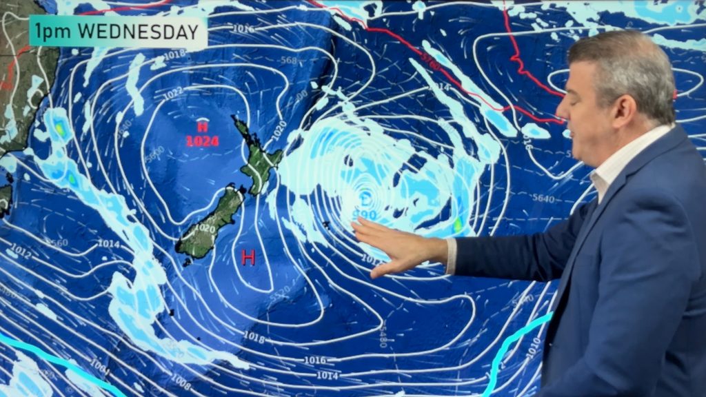
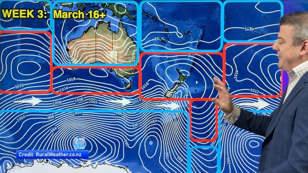
In a nutshell WeatherWatch.co.nz sees the next month ahead as generally warmer than average – but due to storms and lows still remaining active south of NZ we maintain an elevated risk of a snow or frost event this month.
The tropics aren’t too active just yet, but as we go through the month we do see a bit more low pressure forming and tropical rain and convergence zones expanding … and that is normal as we head into the wet season for tropical parts of Australia and the tropical islands north of New Zealand – but the high pressure belt north of our country needs to clear away before we notice any change to the current NZ and Australia weather patterns, and for now that is still not locked in. High pressure north of NZ will also stop NZers from noticing any potential La Niña related weather that may be developing. Those northern highs and Tasman Sea highs will need to clear away and park to the east of NZ for that to alter our pattern – and that is not yet forecast in any obvious way.
Rain is likely to be normal to above normal in many places this month – but not everyone will get the rain they need, with some parts of the east of NZ (perhaps North Canterbury and coastal Hawke’s Bay) leaning normal to below normal. There are rainmakers in the mix for both main islands – but so too are some big high pressure zones and more westerly winds too.
Bureau of Meteorology (BoM) “Climate Driver” statement (Issued October 1):
ENSO to remain neutral
The El Niño–Southern Oscillation (ENSO) is neutral, with both sea surface temperatures (SSTs) in the central equatorial Pacific Ocean and atmospheric patterns at ENSO-neutral levels. While some atmospheric indicators such as pressure, cloud and trade wind patterns over the Pacific have been more La Niña-like over the past few weeks, there has yet to be a consistent/sustained signal.
The Bureau’s model suggests SSTs are likely to remain within the ENSO-neutral range (−0.8 °C to +0.8 °C) throughout the forecast period to February 2025.
Of the 6 other climate models surveyed, 3 suggest SSTs in the tropical Pacific are likely to exceed the La Niña threshold (below −0.8 °C) from October, and another 3 models forecast SSTs to fall just short of the threshold from November.
Should a La Niña develop in the coming months, it is forecast to be relatively weak (in terms of the strength of the SST anomaly) and short-lived, with all models indicating a return to neutral by February
– BoM
Spring weather looks to carry on, milder than usual overall and rainfall looks broken up across many regions (ie, not just leaning on one side of NZ). In saying that, more westerlies are yet to blow through and that does tend to stack up wet weather in the west while making the east drier and cooler.


So keep it simple – most of our weather is being generated by highs and lows more local to NZ and Australia, and are often being controlled by the storms south of NZ over the Southern Ocean – rather than anything connected with the equatorial region of the Pacific Ocean.


- ClimateWatch is a premium product made by WeatherWatch.co.nz for RuralWeather.co.nz
- WeatherWatch.co.nz is proud to be a small Kiwi business providing unique services to help farmers, growers and tradies across all parts of New Zealand!
Comments
Before you add a new comment, take note this story was published on 4 Oct 2024.


Add new comment