ClimateWatch: AUGUST has more BIG highs & lows slowly moving through (+9 Maps & Video)
1/08/2024 2:24am

> From the WeatherWatch archives
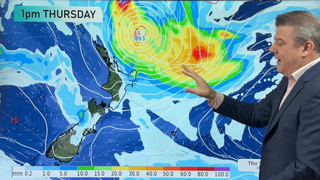
The winter of “big air pressure” continues around NZ with another massive high pressure zone kicking off the first week of August. In fact some modelling suggests it dominates our weather for the first half of August bringing drier than usual weather across much of NZ.
An area of low pressure lingers for the first three or four days of August though – bringing rain and showers to the upper North Island.
Behind this high pressure zone in half a month might be a low with sub-tropical connections, but at this early stage it’s too far out to lock in.
The general theme for AUGUST is similar to JUNE & JULY with more slow moving, and very large, highs and lows.
The neutral weather pattern we’re in looks to remain in play for the rest of 2024.


KEY:
Green to Blue 1 to 15mm.
Yellow & Gold: 15 to 40mm.
Red: 60 to 100mm.
Purple to dark blue: 100mm+


- WeatherWatch.co.nz / RuralWeather.co.nz / Alerting App
Comments
Before you add a new comment, take note this story was published on 1 Aug 2024.
Latest Video
Subtropical low (yes, another one) to brush the NI, high pressure still in charge
A subtropical low will power up over the next 24 hours and brush past the north-eastern corner of the North…
Related Articles
Subtropical low (yes, another one) to brush the NI, high pressure still in charge
A subtropical low will power up over the next 24 hours and brush past the north-eastern corner of the North…
NZ weather: Skies will get drier before they get any wetter
High pressure is the main feature of New Zealand’s weather this week, the upcoming weekend and likely kicking off next…

NZ 8 Day: High pressure to return, also monitoring tropics next week
A cooler change is moving into NZ tonight and Saturday then winds ease further on Sunday as high pressure starts…


Add new comment