> From the WeatherWatch archives
It may feel like it will never be cool over the western parts of the nation again, but southwestern WA should see some respite from the scorching temperatures towards the end of the coming week.
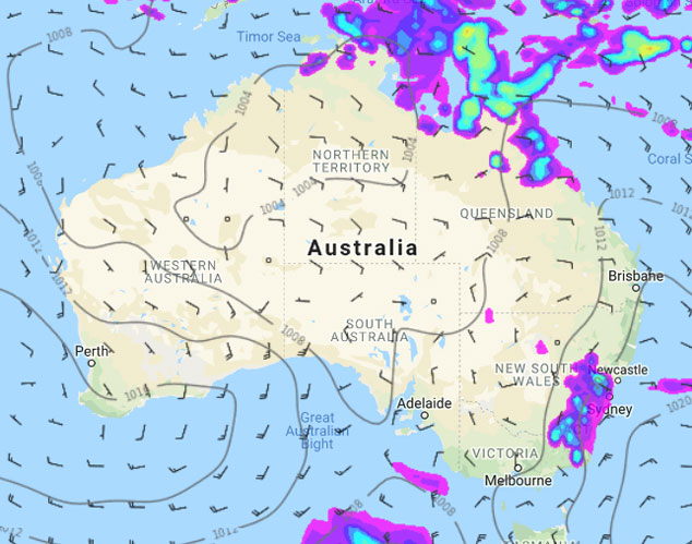
A low pressure trough, commonly referred to as a ‘heat trough’ over this part of the country, is doing exactly as the name would suggest: transporting furnace-like air from the Pilbara down to the southwestern parts of the state and its interior.
Although the odd thunderstorm could always occur with this kind of system, thunderstorm activity is currently concentrated to the Kimberley, where the monsoon trough is enhancing tropical storm activity.
Daytime temperatures are currently peaking in the mid to high 30s across western and southern parts of the state, and are likely to reach around 38 degrees over Perth. Further inland, Kalgoorlie is expected to reach the low 40s by Thursday 10th.
The good news is that a high pressure system is expected to briefly displace the trough towards the east by Friday 11th, pushing in cooler air from the south and bringing a few cooler days in the high 20s and low 30s across the southwestern parts of the state.
Cooling won’t last long though, with heat from the north again rapidly spreading south from about Tuesday 15th as another trough begins to deepen over the western parts of the state.

Image – Friday 11th January 2018 MSLP / Rain map – weathermap.co.nz
Jacobus Cronje – Weatherzone.com.au
Comments
Before you add a new comment, take note this story was published on 7 Jan 2019.


Add new comment