Big high pressure system coming for NZ next week (+2 Maps)
17/04/2018 11:05pm

> From the WeatherWatch archives
A large high, or anti-cyclone, is very slowly drifting towards New Zealand and will finally bring a break to the windy conditions in the South Island and frequent wetter weather along the western side of the country. But between now and this high arriving the winds may pick up even further with various surges of wind coming in from the westerly quarter, mainly the west to south west.
Windiest areas look to be the lower half of the South Island and around Cook Strait and the lower North Island between now and Saturday.
This big high will drift east from Australia (Tasmania area) this weekend and begin settling winds down, especially by Sunday PM.
By Monday the high should cover New Zealand although we do expect a few showers here and there. Winds should be fairly light.
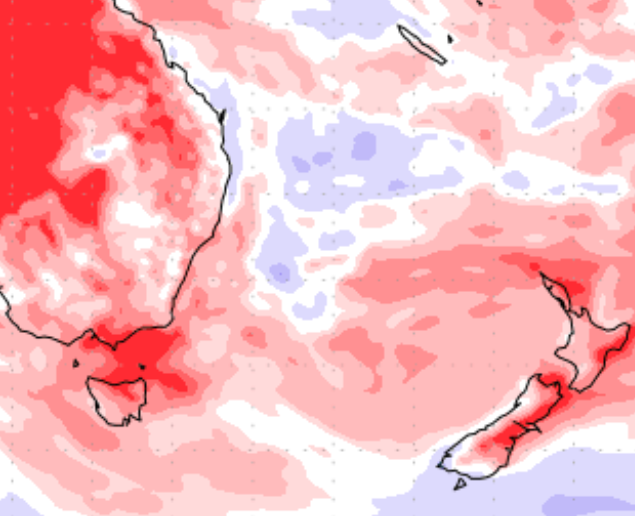
Latest guidance suggests this high may linger for some regions for much of next week, either way most people should have three to five mainly dry and calm days coming with sunniest weather inland through both islands. While there are some showers in the forecast the next seven days ahead do look mainly dry.
7 DAY RAINFALL MAP (Red means drier than usual, white means average rainfall and blue means wetter than usual)

– US Government
AIR PRESSURE MAP FOR MIDNIGHT TUESDAY:

– WeatherMap.co.nz
– WeatherWatch.co.nz
Comments
Before you add a new comment, take note this story was published on 17 Apr 2018.


Add new comment