> From the WeatherWatch archives
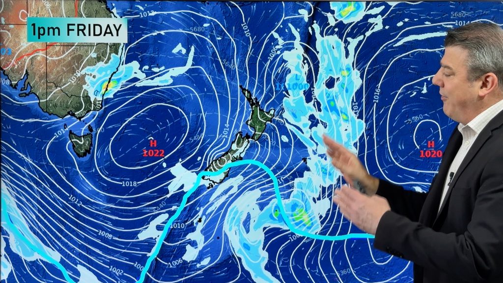
A strong cold front will cross the alpine region on Friday, bringing a good amount of snow for those heading to the resorts this weekend.
It’s been a mostly clear and dry few days across New South Wales and Victorian ski resorts, and a bit of a mixed bag over Tasmanian slopes. Hold on to your lift tickets though, because from Friday a strong cold front will see another burst of snow, following some pre-frontal rain.
With the snowpack still sitting well-above average for most resorts, this next front is expected to deliver around 15-30 cm of new snow to bolster the already excellent conditions we have this winter. Thredbo and Perisher still have well over two metres of snow, Mt Hotham and Falls Creek are just under the two metre mark whilst Mt Buller currently has just under a metre-and-a-half. Unfortunately, this forecast is for the higher resorts, as the air is not as cold as some of the most recent snow events.
Very strong northwesterly winds will bring pre-frontal warmth and rain to the slopes during Friday, but as the winds tend colder westerly, rain will turn to snow and it could accumulate quickly. Around 10-20 cm of snow should fall during Friday afternoon and evening. Flurries throughout Saturday look to bring another 2-5 cm, but unfortunately the snow will stop falling on Sunday when the cold air finally catches up.
Sunday will most likely be the pick of the days this weekend, but if you get there early enough on Saturday and are prepared to put up with some gusty winds, there’s a good chance you’ll be making new tracks in a fresh cover of natural snow.

– By Craig McIntosh, Weatherzone
Comments
Before you add a new comment, take note this story was published on 31 Aug 2018.


Add new comment