Australia on fire – Massive smoke clouds smother Sydney, cover NZ too
5/12/2019 10:30pm

> From the WeatherWatch archives
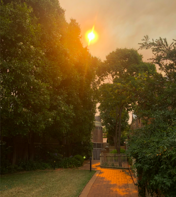
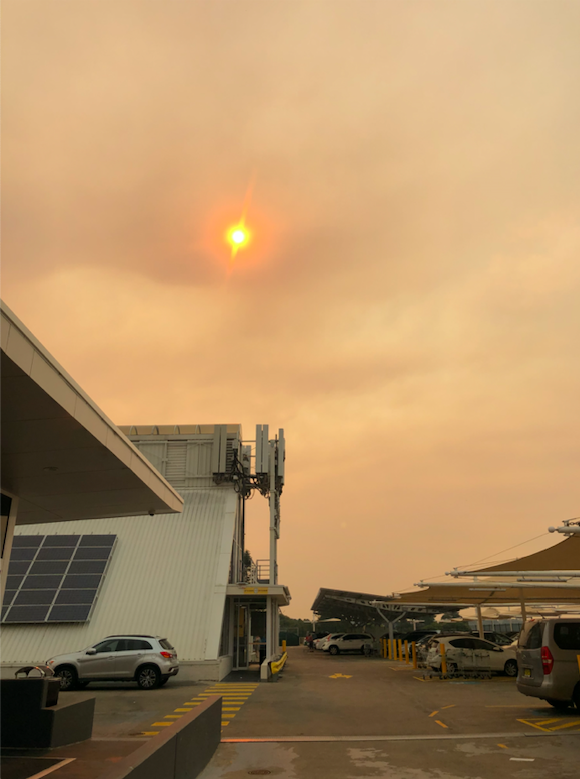
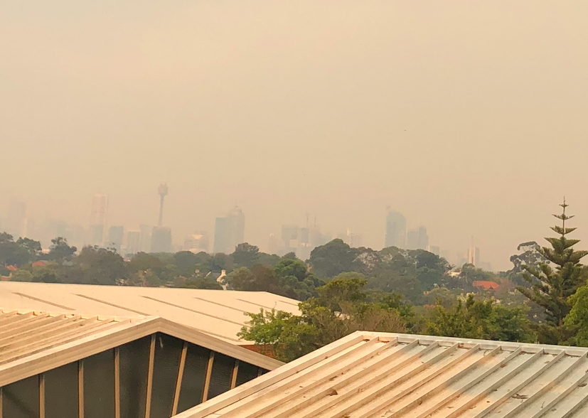
Updated 8am NZDT/6am AEDT — Bush fires along eastern Australia flared up Thursday with a huge pulse of smoke and dust crossing the Tasman Sea, covering parts of New Zealand and smothering Sydney with thick smoke.
Those suffering from asthma and allergies may be affected by the smoke in both Australia and NZ and closing doors and windows may help.
The airflow, thanks to a storm in the Southern Ocean, favours a direct line to New Zealand right now with smoke continuing to blow over the Tasman Sea on Friday and possibly into Saturday too.
Air pollution levels in New Zealand, according to agicn.org had been affected by this smoke with “moderate” pollution in some areas on Thursday evening. As of 8am Friday only Auckland had “moderate” ratings with a very orange tinge to the morning cloud and any sunny spells.
But Australia is far worse with air pollution levels at some locations now deemed as “very unhealthy” as the fires continue to burn. This has not changed as the fires continue rage.
There is a huge amount of #smoke (some normal cloud too) out over the Tasman Sea. Here’s a very rough outline showing where the bulk of the smoke is as we head towards 9am NZDT / 7am AEDT.
News/Maps here: https://t.co/ytCtSBIDXY pic.twitter.com/9CTCYWW37S
— WeatherWatch.co.nz (@WeatherWatchNZ) December 5, 2019
Current fires as of 8am NZDT/AEDT:

 PHOTOS: Thick smoke blanketing Sydney at 5pm local time (7pm NZDT). Credit: Claire Murphy


Smoke from the #Australian bushfires is smothering #Sydney right now & blowing across #NewZealand‘s North Island. If you have asthma or breathing difficulties/allergies keep doors/windows closed.
Smoke will continue to cross the Tasman on Friday.
Imagery courtesy RAMMB/CIRA pic.twitter.com/l4gs6MTOMh— WeatherWatch.co.nz (@WeatherWatchNZ) December 5, 2019
Comments
Before you add a new comment, take note this story was published on 5 Dec 2019.


Add new comment
Guest on 6/12/2019 12:24am
As a result of the Aussie Bush Fires, could there be an increase in particulates in the atmosphere allowing water vapor in the air to coalesce around said particulates leading to an increase in precipitation mid-Tasman and over New Zealand?
Just curious, Paul w Jackson.
Reply
WW Forecast Team on 6/12/2019 1:59am
Hi Paul, probably unlikely due to the incredibly dry air that is pushing out of Aussie at the moment but you may get a better answer from a forecaster at MetService on this specific question. Certainly the smoke has created clouds near Australia but the rain radar imagery from Australia is not accurately showing rain – it’s smoke/dust.
Cheers
Phil D
Reply