Australia: Cyclone Blake forms near Broome, WA (+9 Maps)
6/01/2020 4:59am

> From the WeatherWatch archives
Extensive Update: A Tropical Cyclone has been named by Australian forecasters. Tropical Cyclone Blake, near Broome, is currently Category 1 but may climb up another notch to Category 2.
This means it will likely bring some flooding and wind damage at the lower levels to the western desert side of Australia.
THE IMMEDIATE CONCERN:
Cyclone Blake, Category 1 as of 6pm NZDT (1PM AWST) is expected to reach Category 2 (out of a maximum of 5) by Tuesday as it hugs the north western coastline of Australia:
CURRENT Bureau of Meteorology (BoM) tracking map for Cyclone Blake:
JTWC Tracking (US Govt) as of Monday PM:

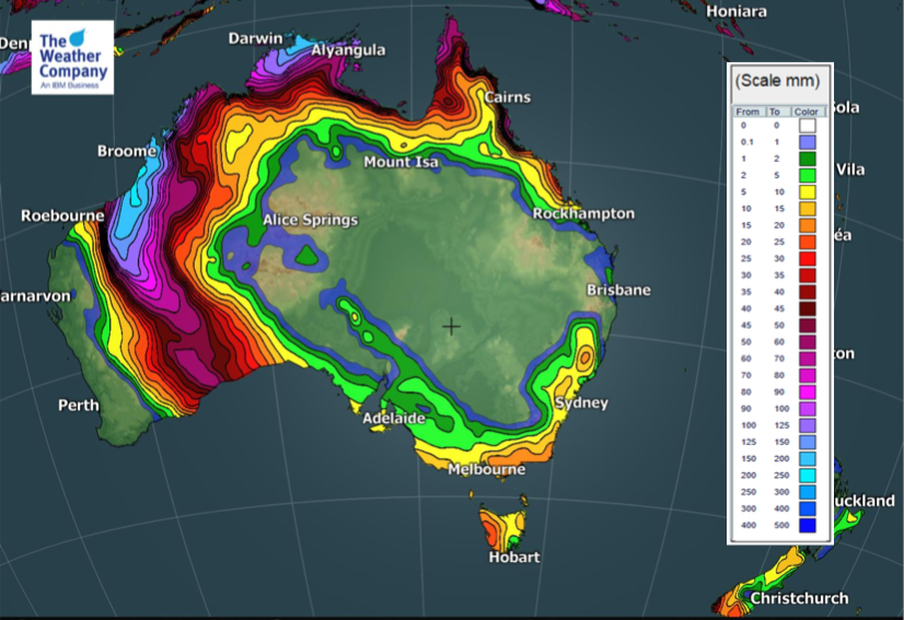
FORECAST RAINFALL for the next 72 hours (from 5am Monday NZDT, 12am Mon AWST)
THE REMNANTS OF CYCLONE BLAKE MOVE INLAND AND SOUTH:
Cyclone Blake is looking like a fairly low level storm with a short life, but very important if you live in WA to pay close attention to BoM warnings.
However the remnants (basically the leftover rain clouds and low pressure system/depression) are likely to drift through inland Australia, over areas that have already had some downpours over the past week:
MORE RAIN COMING:
And even more rain is coming as the remants of Cyclone Blake track South East (SE) across Australia.
Here’s the next 5 days showing the rain band swinging SE and tracking down to the Great Australian Bight.
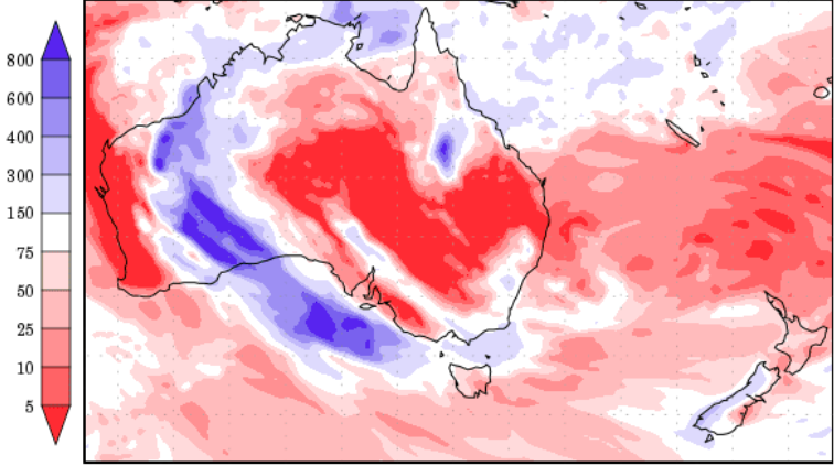
7 DAYS COMPARED TO NORMAL: The next 7 days rainfall in percentage compared to normal (red=drier, white=average, blue=wetter). Data thanks to the US Government. Numbers on left show % compared to normal rainfal for this time of year:
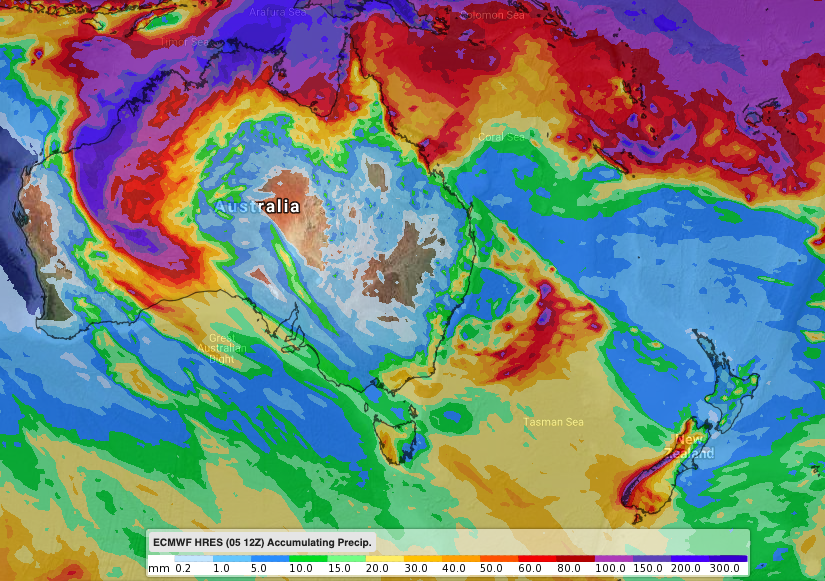
FORECAST RAINFALL TO NEXT NEXT WEDNESDAY NIGHT (JAN 15)
UNRELATED SIDE NOTE: SOME RAIN FOR VIC & NSW BUSHFIRES:
Rainfall map from today (Mon Jan 6) to next Wednesday PM (Jan 15) (Data via ECMWF):
– WeatherWatch.co.nz Exclusive
Comments
Before you add a new comment, take note this story was published on 6 Jan 2020.


Add new comment