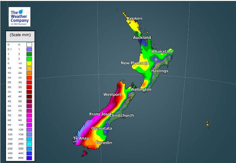
At a glance: Rainfall past 4 weeks & yesterday + Next 7 days coming up
20/04/2020 7:52pm

> From the WeatherWatch archives
The past four weeks saw showers return to drought zones and it has made a positive impact, even though it’s still not enough to return to normal conditions yet. In fact not even close with a rainfall deficit for over a year now in some places.
But it’s been positive to see showers falling and more are forecast in drought zones over the coming week.
These maps from IBM show, generally, rainfall across the country over the past 4 weeks, the past 24 hours and the best thinking on rainfall coming up over the next week.
Much of NZ looks to be drier than normal for the rest of April.


DEPARTURE FROM NORMAL RAINFALL:

To drill down deeper, try the world’s largest weather data website for New Zealand: www.RuralWeather.co.nz
Comments
Before you add a new comment, take note this story was published on 20 Apr 2020.


Add new comment
josh on 20/04/2020 9:46pm
that pink dot south auckland is where i am. i had a bit of rain last week.
Reply
Alice on 20/04/2020 8:55pm
I sure hope the recent rain in Auckland helped to fill the dams up.
Reply
Rob on 20/04/2020 8:28pm
We’ve had good steady rain here in Kaitaia for the last three and half hours this morning!!
Reply