A few cooler nights ahead for New Zealand then warmer later next week
22/02/2020 2:03am

> From the WeatherWatch archives
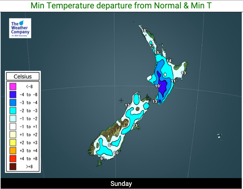
Humidity will ease and temperatures are dropping as a southerly quarter airflow spreads up and over many parts of NZ this weekend.
Temperatures over Saturday and Sunday nights will be below average in a number of regions and single digit temperatures on Sunday morning before sunrise through well inland parts of the South Island could get within five degrees of freezing.
Saturday night/Sunday morning is the coolest period of air for the South Island. Sunday night/Monday morning will be the coolest period for the North Island.
The cooler air flow is as high pressure moves into NZ from the west. When highs first arrive from the west they often bring cooler southerly quarter flows due to the anticyclonic winds they create.
As this next high moves across NZ this week the air will gradually warm up. By late this week, as this high starts to depart, the east to nor’east flow will help lift temperatures in New Zealand further – along with pulling in higher humidity.
So, by the end of this week those same inland South Island regions that at dawn on Sunday morning will be in mid single digits will be around the mid teens! A good demonstration of how high pressure systems often move in with a cooler, drier, change but depart with a cloudier, more humid airflow that brings a higher chance of wetter weather.


– WeatherWatch.co.nz
Comments
Before you add a new comment, take note this story was published on 22 Feb 2020.


Add new comment