> From the WeatherWatch archives
Developing Story
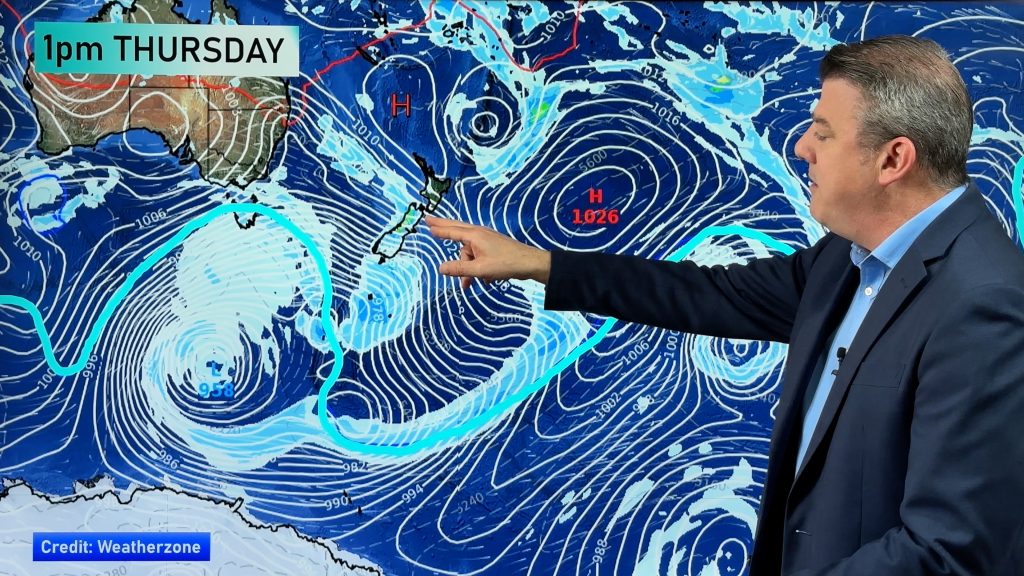
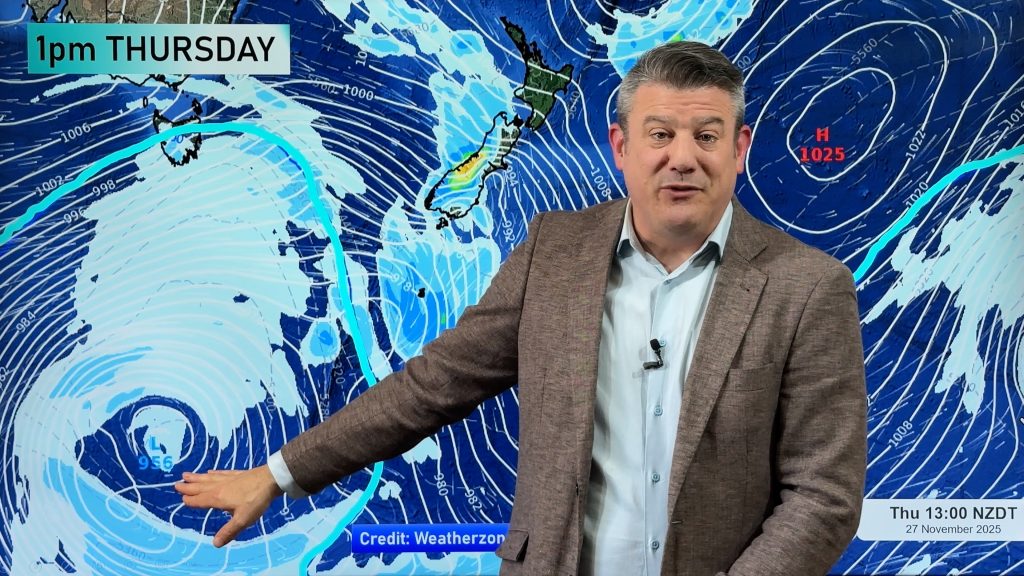
The latest weather charts produced by our government forecaster is showing a central air pressure of 959hPa around midnight near Auckland, Saturday, which would not just break the local record for air pressure, but smash it according to Philip Duncan, Head Weather Analyst at the Weather Watch Centre. “This is unbelievably low and mimics that of modest Atlantic Hurricanes we see on TV. The air pressure, at 959hPa, indicates that this storm will be an intense one”.
Mr Duncan, along with MetService, is warning people in the upper North Island to take extreme care this weekend and to plan for the worst. “Make sure you have your survival kits ready and if you live near small streams you need a plan in case it floods”.
According to weather charts the Cyclone will be at it’s peak when it passes near New Zealand’s largest city, Auckland.
The sub-tropical low continues to rapidly deepen north west of New Zealand and is expected to pass Auckland late Saturday and early Sunday.
Air pressure within the low is rapidly dropping and it’s expected to develop into a storm that’s equal to a category 2 or 3 tropical cyclone by Saturday afternoon or night with winds averaging 130km/h at the centre and gusts much higher.
As of 11pm Friday an easterly was developing over Northland along with patchy rain. On the latest satellite maps the low is starting to become increasingly visible.
Philip Duncan says the storm is rare and nasty and poses a “significant risk” to life and property. “We’re not trying to alarm people but the public in northern New Zealand need to be prepared for this major storm tomorrow. Some people will lose roofs, some will lose power, and some will be isolated by floods and slips. This storm is serious and we are expecting some damage”.
But Mr Duncan says there is one significantly positive feature about this storm – and that is the speed it will move through. “While we’re warning of the likely damage the storm should move through relatively quickly thanks to no blocking High in the east. On Friday night the storm was travelling quickly south east at over 50km/h. This should reduce the amount of damage”.
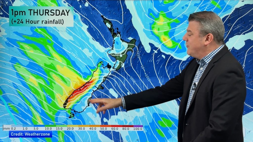
The Weather Watch Centre says torrential rain, massive waves and storm surges could flood a number of low-lying areas across north eastern New Zealand as the subtropical storm moves in. “It may well be the most intense sub-tropical storm of the decade”.
Latest MetService weather charts show the air pressure with this system could drop to 966hPa for a time on Saturday night near Auckland which Duncan says is unheard of. “This could help create one of the biggest storm surges seen in the upper North Island for several years with this potentially record breaking low pressure reading. If this forecast eventuates we could see storm surges flooding low lying eastern coastal areas from Northland to Auckland and across Coromandel and Bay of Plenty. It may also pose a serious risk for low lying areas around the Firth of Thames which is particularly vulnerable to northern storm surges”.
Latest government weather maps show the “eye” of the storm now may move across eastern Northland and north-eastern Auckland. “The strongest winds and the heaviest rains look increasingly likely to hit northern New Zealand” says Mr Duncan.
Mr Duncan says the sub-tropical cyclone is the nastiest since Tropical Cyclones Fergus and Drena in the Summer of 96/97 and may well be worse.
“In the Fergus storm winds reached 225km/h on Mt Te Aroha before the wind gauge broke. Winds in the Eastern Waikato town of Te Aroha reached 180km/h. Our Weather Centre is predicting gusts on Saturday night and Sunday morning may reach 180 to 200km/h in some exposed pockets along the western side of the Kaimais/Eastern Waikato. Other Northern regions may see gusts as high as 150km/h”.
MetService has issued over a dozen rain and wind warnings for the top half of New Zealand. They can be found in the weather section at www.newstalkzb.co.nz
Meanwhile another big storm in the northern Tasman Sea is predicted for early to mid next week travelling on a similar path except slightly further south which could see torrential rain over western and northern regions of both islands. “We’re in for a very stormy 7 days…everyone across New Zealand needs to be on high alert for these storms”.
This is a developing weather story and the Weather Watch Centre will closely monitor the situation and will update if the forecast models appear to strengthen or weaken over the coming day or two.
Comments
Before you add a new comment, take note this story was published on 25 Jul 2008.


Add new comment
Guest on 14/01/2009 10:26am
just wondering about the lightning storm happening over orewa way at the moment? its been going for over 30 mins and looks angry…….
Reply
Guest on 12/01/2009 4:04pm
My son, on a study abroad program in Auckland from the US, messaged me that indeed your weather is rare and setting a decade record. It is wonderful to be able to monitor his trek and as well see his is very well informed. D Reed Atlanta GA US
Reply
Irene on 26/07/2008 4:39am
Hi there, it’s now 4.30pm im in ruakaka have we seen the worst of this storm or is there more to come? Thanks.
Reply
Kay on 26/07/2008 4:15am
Hi there
Just discovered your site today whilst trying to get info on the storm. FANTASTIC and very informative thanks. Have told others. We are in Whangarei, can you tell us if the worst has past? It seems to have quietened down now. The eye of the storm went past around 1.30pm. Thanks.
Reply
WW Forecast Team on 26/07/2008 7:45am
Thanks heaps for your feedback…REALLY glad you like the site!!
Eye is just passing over Whangarei this hour (7 to 8pm). Stronger sou’westers will pick up overnight but they wont reach the speeds they clocked today!
Cheers
Philip Duncan
Reply
kath on 26/07/2008 12:27am
hi there. hope you can keep up with the questions.
i live in muriwai valley auckland west coast beaches. will this area escape the worst????????? thanks in anticipation.
Reply
WW Forecast Team on 26/07/2008 12:30am
Hi Kath…it’s a wet Saturday, I don’t have much else on! lol
Yes you;re probably a bit more sheltered over there, but still it will be very stormy after dark. Actually, you should be more concerned about next weeks storm (Tues/Weds) as it’ll be a west coast one I believe.
Stay safe
Cheers
The Weather Watch Team
Reply
Guest on 25/07/2008 9:31pm
my husband and son are planning to travel from te awamutu to north shore on sun am….do they need to change their plans at all? thanks heaps
Reply
WW Forecast Team on 25/07/2008 9:37pm
Best to check in the morning…the storm may ease significantly by then but safest bet is to check in the morning – and don’t forget to check Time Saver Traffic.
Cheers
The Weather Watch Team
Reply
View more comments