Wintry weather for some this week but everyone has a mild weekend coming (+9 Maps)
24/09/2018 12:36am

> From the WeatherWatch archives
The final week of September will be one of the coldest of the month for some regions but the final weekend looks mild as a typical spring pattern kicks in.
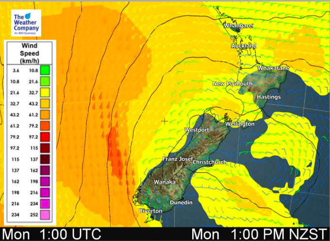
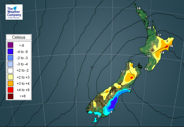
Expect a mixture of warm and cold days over the next month ahead as we transition away from winter and shift further towards summer. This week will be a cold one for many, although Monday may be warmer than average for some northern and eastern parts of the North Island.
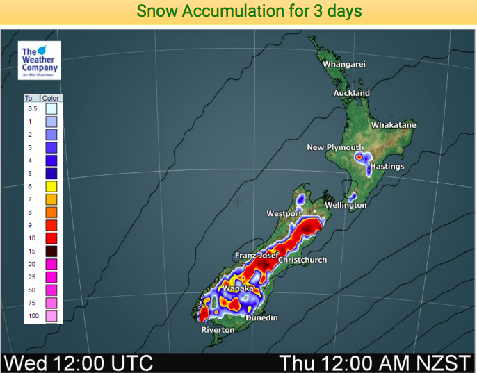
Already snow has fallen down to a couple of hundred metres in some parts of the South Island with the next wave of colder air expected tonight, bringing more snow to the mountains and ranges and likely some farms. The positive is that WeatherWatch.co.nz does see a very slight lift in daytime temperatures this week compared to what was being forecast last week. While only 1 or 2 degrees it is enough to lift the snow level just slightly higher than most main centres.
However the Misery Index (cold + dampness = miserable) is fairly high this week in Southland and Otago especially and there won’t be an easing of this until about Thursday or Friday. In other words, even with a tiny lift in snow levels the stress for newborn stock will be high to extreme in Southland and Otago in particular from today until Thursday.
- TIMELINE:
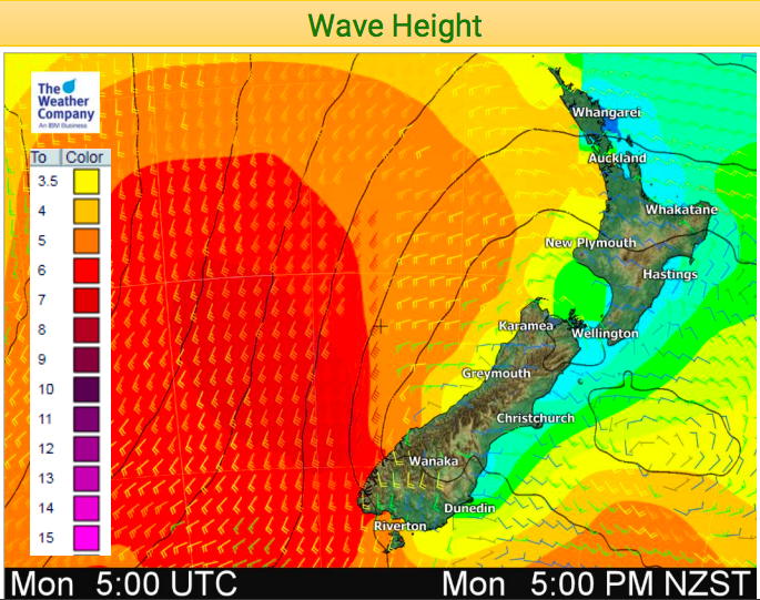
- Monday – First cold wave sweeps up the country, reaching northern NZ tonight.
- Tuesday – Colder in the North Island but a couple to a few degrees warmer in Southland and Otago and other South Island regions, but this is ahead of the next bigger cold change.
- Wednesday – Main polar southerly arrives, coldest day of the week for many in the lower South Island but may be a tad milder in the North Island again.
- Thursday – A slight warming up as a westerly develops further south, colder in the North Island as the last and main part of the southerly moves through. (winds may be WSW for some though).
- Friday – Nor’westers develop in the lower South Island and there should be a feeling in the air of positive change.
- This Weekend: Warmer than average for most regions thanks to sub-tropical and Australian nor’westers.
This weekend is shaping up to be a mild one nationwide thanks to the incoming sub-tropical and Australian air flows. Temperatures this Saturday and Sunday in both islands will push into the late teens and even early 20s for some in the north and east.


– WeatherWatch.co.nz
Comments
Before you add a new comment, take note this story was published on 24 Sep 2018.


Add new comment