Weekend Weather: A lot of cloud, some isolated drizzle and heavy rain too (+ Maps)
1/03/2018 8:12pm

> From the WeatherWatch archives
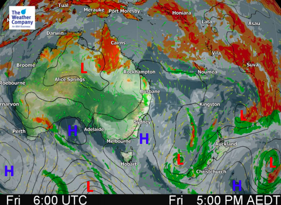
Two lows are working together to produce a mostly cloudy weekend across New Zealand with isolated heavy rain and drizzle patches too.
For the most part New Zealand looks fairly dry this weekend but rain could become heavy on the West Coast with some very localised totals potentially exceeding 150mm, like around the Franz Josef area. However a little further away and the totals are significantly reduced.
The weak but sizeable low in the Tasman Sea will weaken further this weekend and then fall apart by Monday, with the leftovers crossing the South Island in the form of patchy rain on the West Coast. At the same a small sub-tropical low will move down (on Monday) across East Cape and the eastern corner of the North Island bringing some rain or showers there.
By mid next week high pressure will be growing around southern New Zealand while at the same time a very large sub-tropical low may be forming over northern New Zealand. This next system remains “one to watch” as it may produce strong winds and heavy rain in the North Island late next week or weekend (not locked in yet).


– Maps by The Weather Company
– WeatherWatch.co.nz
Comments
Before you add a new comment, take note this story was published on 1 Mar 2018.


Add new comment