Wednesday’s national forecast – Unsettled and wet (+10 maps)
14/12/2021 3:00pm

> From the WeatherWatch archives
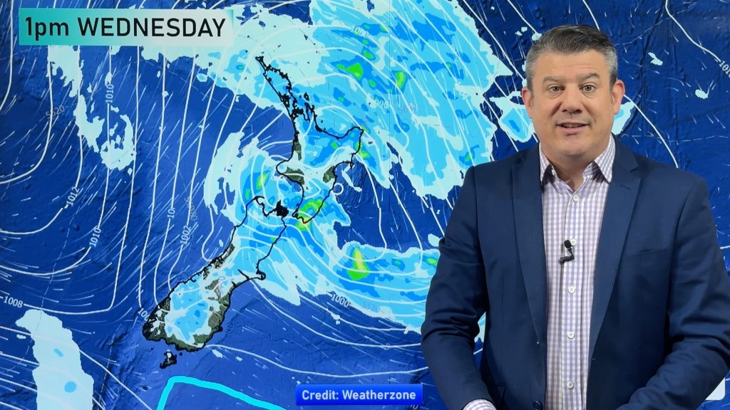
A large low pressure system centered in the Tasman Sea brings unsettled weather to New Zealand today, plenty of rain too in some spots. Southland and Fiordland stay dry though with some sun.
Please refer to your local, hourly, 10 day forecast for more details.
Northland, Auckland, Waikato & Bay Of Plenty
Showers becoming few in the afternoon for Northland and Auckland, sunny spells break through with northwesterly winds. Bay Of Plenty has heavy rain this morning then easing during the course of the afternoon as a front moves through, northeasterlies tend northwest. Rain about eastern Bay Of Plenty and East Cape may be torrential then easing late afternoon or evening.
Highs: 23-25
Western North Island (including Central North Island)
Morning rain eases to showers as easterlies change northwest, chance of a heavy fall and thunderstorm in the afternoon then easing in the evening and clearing.
Highs: 21-24
Eastern North Island
Rain, heavy about Gisborne, easing and clearing in the evening. Blustery northeasterlies ease later today.
Highs: 24-25
Wellington
Rain, easing late afternoon or evening as fresh southeasterlies ease.
Highs: 22-23
Marlborough & Nelson
Rain with heavy falls for Marlborough, easing in the evening, fresh southeasterlies.
Highs: 19-22
Canterbury
Rain, heavy about North Canterbury. Rain may become particularly heavy from afternoon about the coast and especially Banks Peninsula. Southeasterlies tend fresh southwest later in the day.
Highs: 14-16
West Coast
Mostly cloudy with spits and showers, perhaps some rain at times. Fiordland is dry with high cloud. Breezy southeasterlies.
Highs: 20-25
Southland & Otago
High cloud for Southland. Otago is mostly cloudy with some patchy rain from afternoon. Easterly winds, breezy about the coast.
Highs: 16-22
WeatherWatch.co.nz is proud to be setting the international standard for forecasting in NZ – powered by IBM


Comments
Before you add a new comment, take note this story was published on 14 Dec 2021.


Add new comment