Wednesday’s national forecast – SW airflow eases
28/11/2023 11:00am

> From the WeatherWatch archives
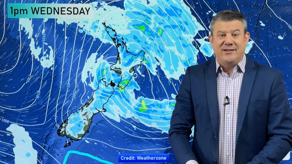
A southwesterly airflow eases over the country today with fronts clearing away to the northeast, high pressure in the Tasman Sea starts to move in.
Northland, Auckland, Waikato & Bay Of Plenty Cloudy areas, a few showers move into Waikato, Auckland and perhaps Bay Of Plenty in the morning, clearing in the afternoon with sunny areas increasing. Southwestely winds.
Highs: 19 – 23
Western North Island (including Central North Island)
Showers, clearing during the afternoon as winds tend southeast. Sunny areas develop after showers clear, more so in the west, staying cloudier towards the eastern ranges.
Highs: 15 – 18
Eastern North Island
Rain for Wairarapa spreads north in the morning with a southerly change, clearing from the south late afternoon into the evening.
Highs: 16 – 21
Wellington
Showers ease, clearing in the afternoon, a few sunny spells break through. South to southeasterly winds die out later in the day.
Highs: 14 – 16
Marlborough & Nelson
Morning rain or showers, easing afternoon, clearing by evening. Southeasterlies tend easterly in the afternoon for Marlborough, light winds tend northerly for Nelson.
Highs: 14 – 17
Canterbury
Showers clear from the south during the morning, sunny spells start to break through in the afternoon. Southwesterlies swing around to the northeast in the evening.
Highs: 14 – 21
West Coast
Sunny for Fiordland with southerlies. Cloudy spells further north with a few showers, light winds tend north to northwest in the afternoon.
Highs: 17 – 19
Southland & Otago
Morning showers clear Southland and coastal Otago then sunny spells increase, Central Otago becomes sunny in the morning. South to southwesterly winds (fresh about the coast).
Highs: 12 – 19
Comments
Before you add a new comment, take note this story was published on 28 Nov 2023.


Add new comment