Wednesday’s national forecast – Low passes by
28/06/2022 12:00pm

> From the WeatherWatch archives
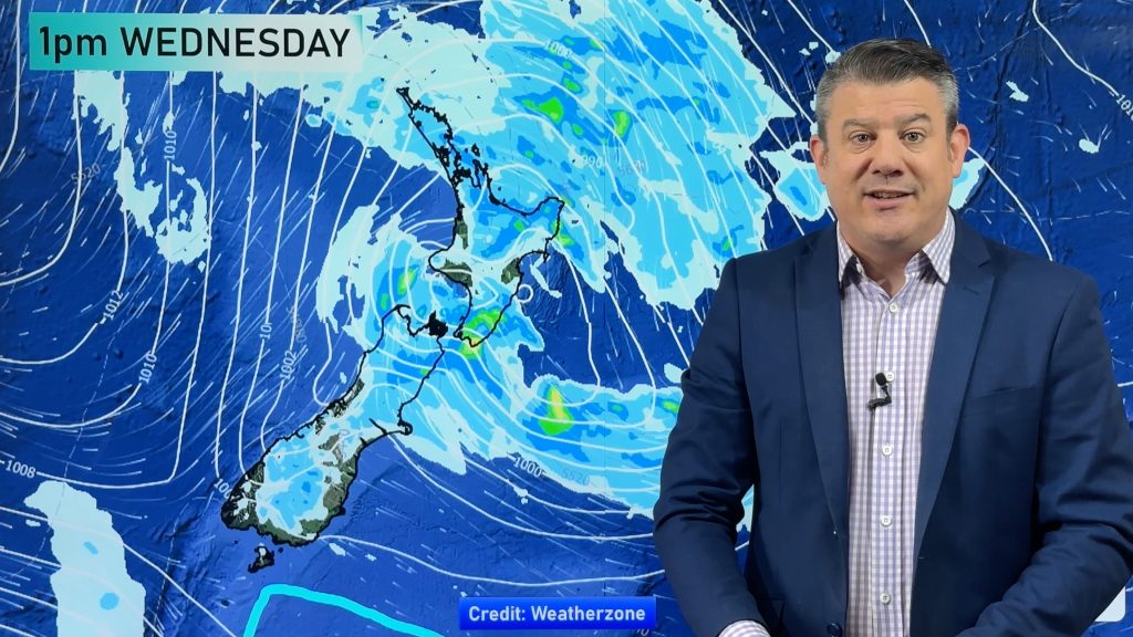
A low passes by the North Island today moving away to the southeast meanwhile a weakening front moves onto the lower South Island this morning.
Northland, Auckland, Waikato & Bay Of Plenty
Mostly cloudy with showers, rain moves through Northland in the morning with a chance of heavy falls, mainly in the east. Rain reaches Great Barrier Island and Coromandel in the afternoon, easing later in the evening. Rain for most places in the evening for a time (apart from the Waikato) then clearing overnight. Light winds then southerlies pick up from afternoon, southerlies may be strong in the evening, mainly for coastal parts.
Highs: 14-16
Western North Island (including Central North Island)
Mostly cloudy with a few showers, clearing in the afternoon and sunny spells may then break through. Light winds.
Highs: 11-15
Eastern North Island
A mix of sun and cloud, a few spits or showers possible for Wairarapa. Cloud thickens in the evening north of Napier bringing in the odd shower as winds tend to the south. Rain develops for northern East Cape in the evening.
Highs: 14-17
Wellington
Morning showers then sunny spells increase from afternoon, light winds.
Highs: 13
Marlborough & Nelson
Morning cloud clears to a sunny day. Light winds for Marlborough, southwesterlies for Nelson.
Highs: 11-14
Canterbury
Any morning cloud clears then sunny with light northwesterlies.
Highs: 4-11
West Coast
Rain for Fiordland, easing from afternoon. Further north there may be morning sunny spells then cloud thickens with the chance of a shower. Southwesterlies.
Highs: 8-12
Southland & Otago
Cloud develops in the morning, a few showers for Southland, sunny areas break through from afternoon as northwesterlies change westerly.
Highs: 8-11
Comments
Before you add a new comment, take note this story was published on 28 Jun 2022.


Add new comment