Weather headlines (x3) for Thursday: Showers in the north, Rain outlook, Fog potential
27/04/2022 7:00pm

> From the WeatherWatch archives
Here’s what is making the weather headlines today.
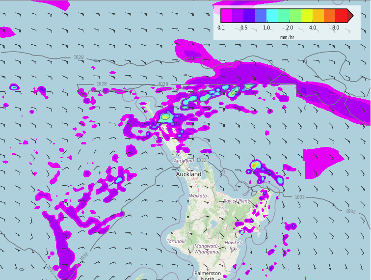
SHOWERS PUSHING THROUGH AUCKLAND NORTHWARDS
The weather around New Zealand is quite settled today thanks to a large high. Showers do push through Auckland this morning though and hang about Northland for much of the day before clearing away to the northwest this evening as a front flicks over.
Hawkes Bay / Gisborne and the West Coast in the South Island are a few other regions to see showers.

RAIN OUTLOOK UPDATE
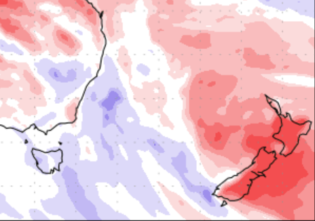
Unfortunately it’s looking fairly dry for at least the next 7 days still. This is fairly obvious when we check out the “Precipitation percentage of normal” map below which runs through to the 5th May. New Zealand is covered in quite a bit of red which means mainly dry weather with little rainfall expected coming up.
We can see some lighter shading about eastern Northland though which does see showers, also the West Coast (more so down towards South Westland). Fiordland has average to perhaps slightly more than average rainfall over the next 7 days, the wettest spot around NZ.

WHERE SKIES ARE CLEAR, LOOK FOR FOG
Over the next 6 or 7 days, where ever skies are clear the night before there is a risk of fog overnight and into the next morning. This is especially so for inland areas away from the coast for both Islands. In the North Island fog will typically be south of Waikato, through into the Central North Island and in other western areas. For the South Island any fog will typically be east of the Main Divide but inland Buller will likely see fog too.
The graph below is for Reefton and as you can see there is quite a bit of fog potential coming up. To check out your location please go to ruralweather.co.nz, use the search function then click on the “Fog/Cloud” tab.

Comments
Before you add a new comment, take note this story was published on 27 Apr 2022.


Add new comment