Weather headlines (x3) for Monday: Wet weather moves in, Frosts from Wednesday, Warmer again Sunday / Monday
8/05/2022 7:00pm

> From the WeatherWatch archives
Here’s what is making the weather headlines today.
COLD FRONT BRINGS SOME WET WEATHER
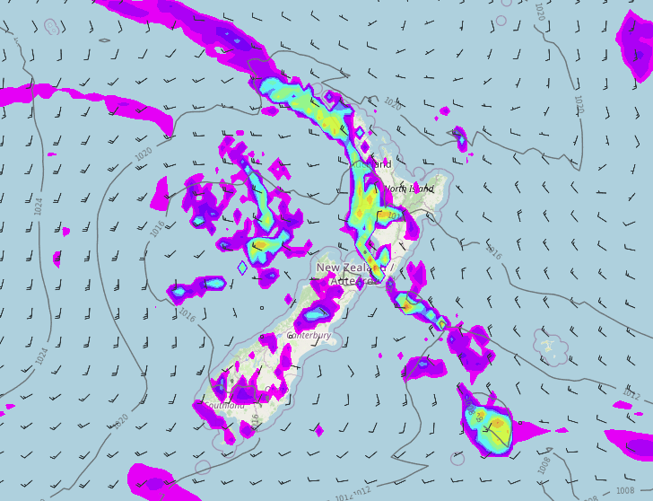
A cold front that moved northwards over the South Island yesterday pushes over the North Island today, expect rain in the west as it moves through. Southerlies bring rain or showers to the east of the South Island and these conditions spread to the eastern North Island overnight.
Some wet weather is welcome considering the settled dry conditions we have had lately, it doesn’t last long though. High pressure starts to nudge in from tomorrow over the South Island then spreading to the North Island on Wednesday leading to another period of settled weather through to Saturday.

Monday 3pm 
Tuesday 3pm
FROSTS FROM WEDNESDAY MORNING
With high pressure moving in from Tuesday expect cold temperatures overnight especially for inland parts of the South Island with frosts looking likely, frosts develop about the Central Plateau also. Thursday morning through to Saturday morning has a chance of frosts also with high pressure hanging around. Keep an eye on our frost risk charts here.

TEMPERATURES START TO WARM UP AGAIN SUNDAY / MONDAY
With the southerly quarter airflow starting to head in today then high pressure following in behind temperatures will be a bit on the cool side for much of the week ahead. When I say cool it’s a little bit of a relative term compared to the warmer weather we had during the past week. Many places will be still and sunny with light winds and that can be quite nice. The upper North Island will likely have highs in the late teens for much of the week ahead.
However for warmer highs overall look forward to about Sunday or Monday next week when a northerly airflow kicks in, then temperatures will rise.
Comments
Before you add a new comment, take note this story was published on 8 May 2022.


Add new comment