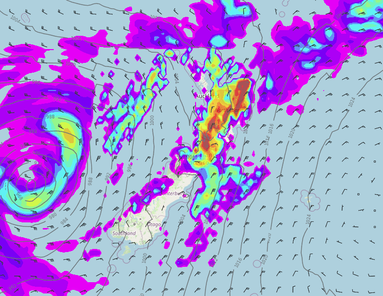
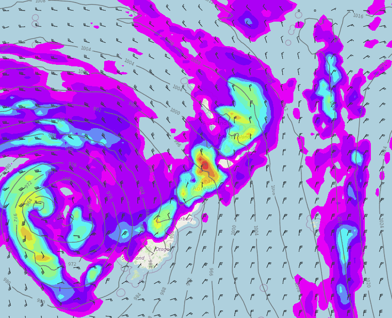
Weather headlines (x3) for Monday: Heavy rain in the north, Warm in the east tomorrow, Next front late Tue / Wed
29/05/2022 7:00pm

> From the WeatherWatch archives
Here’s what is making the weather headlines today.
HEAVY RAIN IN THE NORTH
A front passing over the upper North Island this morning and afternoon brings heavy rain, mainly for Auckland, Waikato, Bay Of Plenty, the Central North Island and across to East Cape. Conditions start to ease once the front has passed through.
North of about Auckland this afternoon showers may become heavy with thunderstorms then easing this evening.
Keep up to date with the latest warnings from Metservice here.

TEMPERATURES WARM IN THE EAST TOMORROW
Temperatures for eastern regions of both Islands tomorrow reach into the late teens or early twenties thanks to a northerly quarter airflow and some sun, warm for the upper North Island also.

ANOTHER ACTIVE FRONT LATE TUESDAY / WEDNESDAY
A front pushes onto western New Zealand overnight Tuesday into Wednesday bringing rain for western regions and a chance of heavy falls plus thunderstorms. The front passes out to the east on Wednesday morning, rain continues for much of the day along the West Coast with thunderstorms possible.

Comments
Before you add a new comment, take note this story was published on 29 May 2022.


Add new comment