VIDEO: Dry weather is expanding over NZ as westerlies dominate southern OZ
6/06/2023 11:23pm

> From the WeatherWatch archives
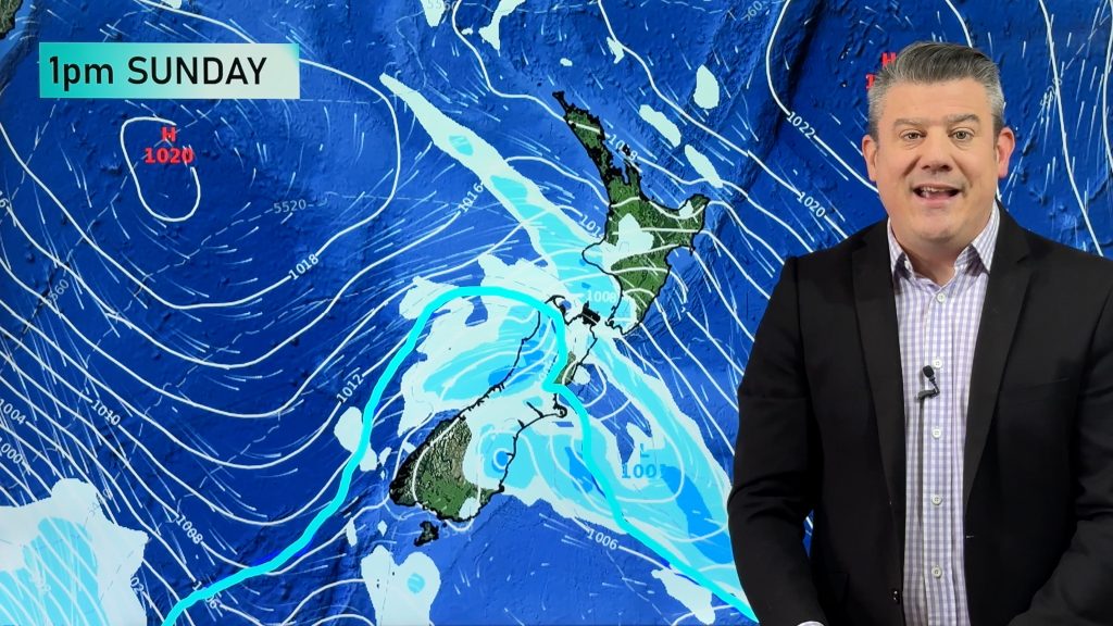
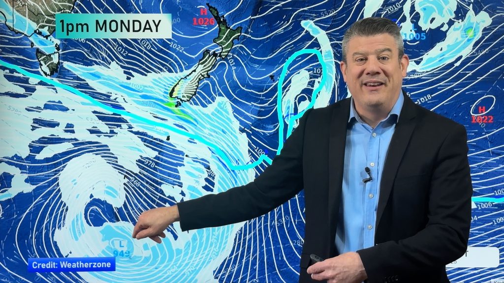
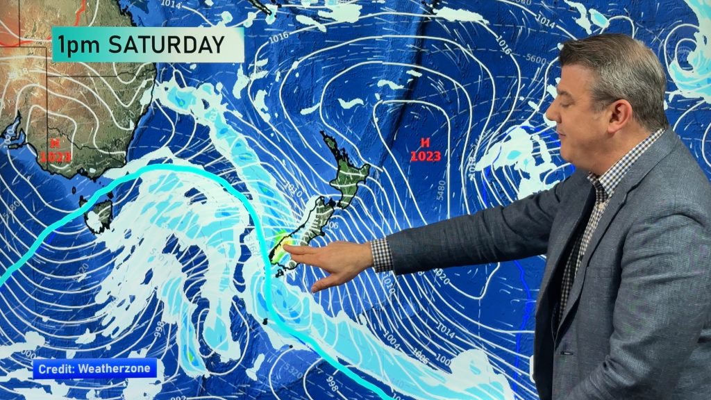
A weak low near the upper North Island will bring further rain and showers to East Cape and Gisborne and surrounding regions, but most other parts of New Zealand are leaning drier than average over the coming week due to more high pressure dominating.
The high pressure zone is bringing widespread frosts to the South Island – check out our FREE Frost Forecaster at RuralWeather.co.nz to drill down deeper.
Meanwhile Australia has another burst of windy westerlies which will juuust reach the lower South Island of NZ this weekend.
We have your forecast out to Monday of next week.
Comments
Before you add a new comment, take note this story was published on 6 Jun 2023.
Latest Video
VIDEO: NZ 10 Day + Labour Weekend sneak peek
Spring weather conditions carry on but some places will be hotter and drier over the week ahead, despite polar changes…
Related Articles
VIDEO: NZ 10 Day + Labour Weekend sneak peek
Spring weather conditions carry on but some places will be hotter and drier over the week ahead, despite polar changes…
VIDEO: Gale westerlies off & on, we track them + the high pressure zones
*Programming Note: We have no video today Thursday (October 16), back Friday! [Video Recorded Wednesday]: Windier weather is coming back…
VIDEO: Some (brief) high pressure coming, but the weekend goes downhill again for some
Some drier, more settled, weather is coming late week for a number of regions – but it won’t hang on…


Add new comment