> From the WeatherWatch archives
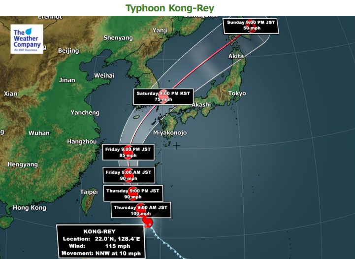
Typhoon Kong-rey is located about 400km southeast of Okinawa, Japan and is tracking north-northwestward quite quicky at 19km/h. According to JMA analysis from Japan, maximum sustained surface wind speeds are 160km/h with gusts over 220km/h, making it equal to category 2 hurricane in the Atlantic.
Himawari satellite imagery shows well-curved convective banding around the center.
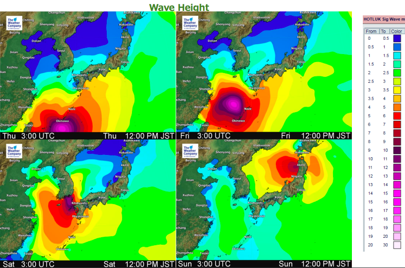
Kong-rey will approach Nansei Islands on Thursday, and will pass across the islands on Friday. At that timing, Kong-rey will keep strong intensity with damaging winds, although it is forecast to slightly weaken. There will be damaging gusty winds, heavy rain and storm surge around Okinawa and Nansei Islands from Thursday to Friday.
Kong-rey will track northward over the East China Sea on Friday, and gradually re-curve to the northeast on Saturday. Then Kong-rey is forecast to approach to off the south coast of the Korean Peninsula and off the north coast of Kyushu around Saturday afternoon. Kong-rey will track northeastward over the Sea of Japan on Sunday, and may strike Northern Japan in the afternoon.


– WeatherWatch.co.nz, with our partners at The Weather Company
Comments
Before you add a new comment, take note this story was published on 3 Oct 2018.


Add new comment