Tuesday’s national forecast – It’s getting wet (+10 maps)
13/12/2021 3:00pm

> From the WeatherWatch archives
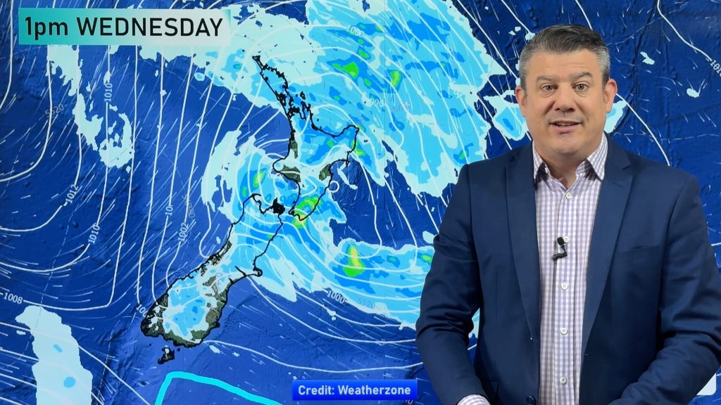
A humid northerly airflow lies over the North Island today bringing rain, rain may be heavy in spots especially from this afternoon about Northland then elsewhere about the upper North Island from evening. The South Island has a southeasterly airflow with rain for the upper half, drier further south.
Please refer to your local, hourly, 10 day forecast for more details.
Northland, Auckland, Waikato & Bay Of Plenty
Showers turning to rain this morning, heavy falls develop (possibly torrential) about Northland this afternoon then elsewhere this evening. Northeasterly winds becoming strong later in the day.
Highs: 23-24
Western North Island (including Central North Island)
Rain with easterly winds, heavy falls possible, especially in the morning about Taranaki and south of about Palmerston North. Easterly quarter winds.
Highs: 18-22
Eastern North Island
Cloudy with patchy rain or drizzle, rain more persistent about Wairarapa. Rain may become heavy overnight. Light winds pick up from the northeast overnight.
Highs: 21-23
Wellington
Rain, heavy falls possible (mainly this morning). Southerly winds.
Highs: 17-20
Marlborough & Nelson
Rain develops in the morning, heavy falls possible about Nelson and the Sounds. South to southeasterly winds.
Highs: 17-19
Canterbury
Cloudy with the odd drizzle patch, rain develops in the afternoon north of Banks Peninsula then spreading a bit further south overnight. Southeasterly winds.
Highs: 18-21
West Coast
Mostly cloudy with some rain about Buller spreading south to about Hokitika this afternoon, Fiordland has mostly sunny weather and some high cloud. Southeasterly winds.
Highs: 21-24
Southland & Otago
Morning cloud then mostly sunny, cloud may be a little more frequent for Otago especially North Otago with a chance of drizzle. East to southeasterly winds.
Highs: 17-24
WeatherWatch.co.nz is proud to be setting the international standard for forecasting in NZ – powered by IBM


Comments
Before you add a new comment, take note this story was published on 13 Dec 2021.


Add new comment