Tuesday’s national forecast – Cold front for the North Island (+10 maps)
16/08/2021 4:00pm

> From the WeatherWatch archives
A cold front pushes over the North Island today, this may bring some heavy rain to western regions. The South Island has an unstable westerly quarter airflow with heavy showers and a chance of thunderstorms / hail in the west. A bit drier in the east but showers develop about the far south then push into Canterbury later this evening or overnight.
Please refer to your local, hourly, 10 day forecast for more details.
Northland, Auckland, Waikato & Bay Of Plenty
Sunny areas and increasing cloud, rain in the afternoon with a chance of heavy falls then easing to showers in the evening as gusty northwesterlies change westerly. Showers may become a little beefy overnight in the west as westerlies freshen.
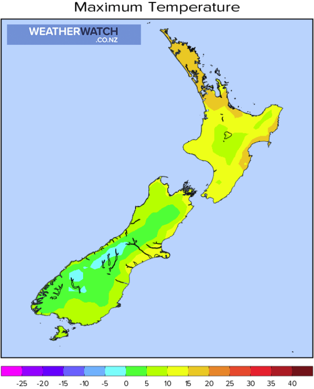
Highs: 15-17
Western North Island (including Central North Island)
Rain, becoming heavy mid to late morning then easing to showers in the evening. Overnight showers may become heavy with a risk of thunderstorms and hail, more so near the coast. Strong northwesterlies ease back a touch by midday.
Highs: 10-15
Eastern North Island
High cloud, rain spreads into Wairarapa from morning then further north from afternoon. Clearing from the south evening onwards. Gusty northwesterlies ease later in the day.
Highs: 15-19
Wellington
Rain, easing to showers in the afternoon as gale northwesterlies ease. Some sun may break through in the afternoon, mainly about the Wellington CBD.
Highs: 13-14
Marlborough & Nelson
Rain, drying out in the afternoon for Marlborough with sun breaking through. Showers continue about Nelson after midday then spreading back into Marlborough overnight. Strong northwesterlies easing a touch from afternoon although still gusty at times.
Highs: 12-14
Canterbury
Some morning scattered rain, more so inland but a few spits may reach the coast then afternoon sunny areas break through. Northwesterly winds, a bit gusty about North Canterbury. Late evening or overnight southwesterlies move in bringing a few showers.
Highs: 11-15
West Coast
Showers, heavy at times with thunderstorms and hail. Breezy northwesterly winds. Showers start to clear about Fiordland in the evening.
Highs: 8-12
Southland & Otago
Morning showers clear, dry for a time then showers move back in in the afternoon, possibly heavy with a risk of small hail then easing in the evening. Snow flurries lower to 600m in the afternoon.
Highs: 9-12
WeatherWatch.co.nz is proud to be setting the international standard for forecasting in NZ – powered by IBM


Comments
Before you add a new comment, take note this story was published on 16 Aug 2021.


Add new comment