Timeline: Deep low to cross NZ this week, followed by short cold snap (+4 Maps)
19/08/2019 8:31pm

> From the WeatherWatch archives
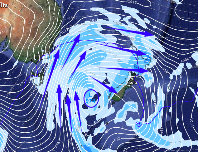
More rain, snow and some squally downpours are on the way then a short lived cold change as yet another deep low pressure system moves into the New Zealand area.
The low comes out of the Southern Ocean and peaks in strength around Wednesday, then moves up the western side of NZ across Thursday and Friday. It crosses over the North Island around late Friday then deepens further again off the eastern side of the North Island on Saturday – but at the same time it then clears away.
Put simply, NZ has a burst of wind and rain then a colder southerly which is short lived.
WEDNESDAY – A deep low in the Southern Ocean moves towards the South Island. Rain arrives on the West Coast later.
THURSDAY – The low arrives in southern NZ and rain pushes across the entire country from the west. Westerly quarter winds pick up – mild in the east. Despite the incoming rain, it remains mostly dry in Canterbury, Otago and Southland.
FRIDAY – The colder southerly arrives in the South Island and later in the day reaches the lower North Island. While colder in the South Island it does become much drier. Rain bands and showers continue for more parts of the North Island.
SATURDAY – The North Island gets the colder southerly change sweeping over which also clears the skies for many. The low deepens again off the east coast and that may keep the southerlies and showers lingering there longer. As the day wears on winds switch to slightly milder westerly for the lower South Island. It’s all over by Saturday night.
– WeatherWatch.co.nz
Comments
Before you add a new comment, take note this story was published on 19 Aug 2019.


Add new comment