Thursday’s national forecast – Cold front hits the far south
29/06/2022 12:00pm

> From the WeatherWatch archives
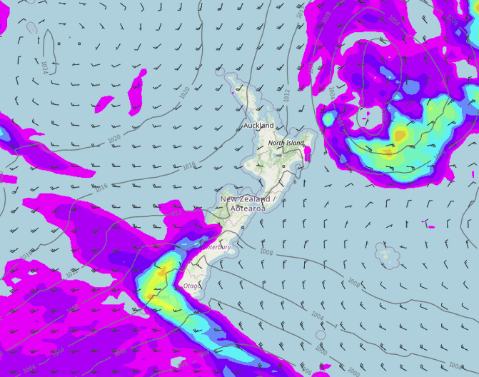
A cold front moves onto the lower South Island around midday today, reaching the upper South Island overnight. Meanwhile a low moves away from the North Island to the east.
Northland, Auckland, Waikato & Bay Of Plenty
Partly cloudy skies with occasional showers in the west, cloud thickens up for a time in the afternoon. Drier weather in the east, mostly sunny for Bay Of Plenty. Breezy southwesterlies.
Highs: 15-17
Western North Island (including Central North Island)
Partly cloudy skies with west to northwesterly winds, freshening in the afternoon. A few overnight showers as winds change to the south.
Highs: 10-16
Eastern North Island
Mostly sunny for Wairarapa with some high cloud developing from afternoon, cloud and a few showers further north then sunny spells increase after midday with easing southwesterlies. Northern East Cape has morning rain easing to a few showers, clearing by evening.
Highs: 14-16
Wellington
Mostly sunny with some developing high cloud, a southerly change around midnight brings a few showers.
Highs: 14-15
Marlborough & Nelson
Mostly sunny with high cloud increasing from afternoon, a southerly change later in the evening or overnight brings a few showers, mainly for Marlborough.
Highs: 12-15
Canterbury
Sun and thickening high cloud, evening rain as a gusty southwest change moves through, rain clears overnight. Snow may lower to 400m for a time before clearing.
Highs: 8-17
West Coast
Mostly cloudy with the odd shower, rain develops for Fiordland in the morning, spreading into North Westland in the evening as southwesterlies freshen. Snow lowers to 400m in the evening for Fiordland, 600m further north. Showers clear overnight but remaining for Fiordland and north of Greymouth.
Highs: 10-14
Southland & Otago
Dry with high cloud, northwesterlies change southwest around midday for Southland bringing rain, rain moves into Otago during the afternoon, easing to showers in the evening. Showers clear overnight for Otago. Snow lowers to 400m when rain eases to showers.
Highs: 10-14
Comments
Before you add a new comment, take note this story was published on 29 Jun 2022.


Add new comment