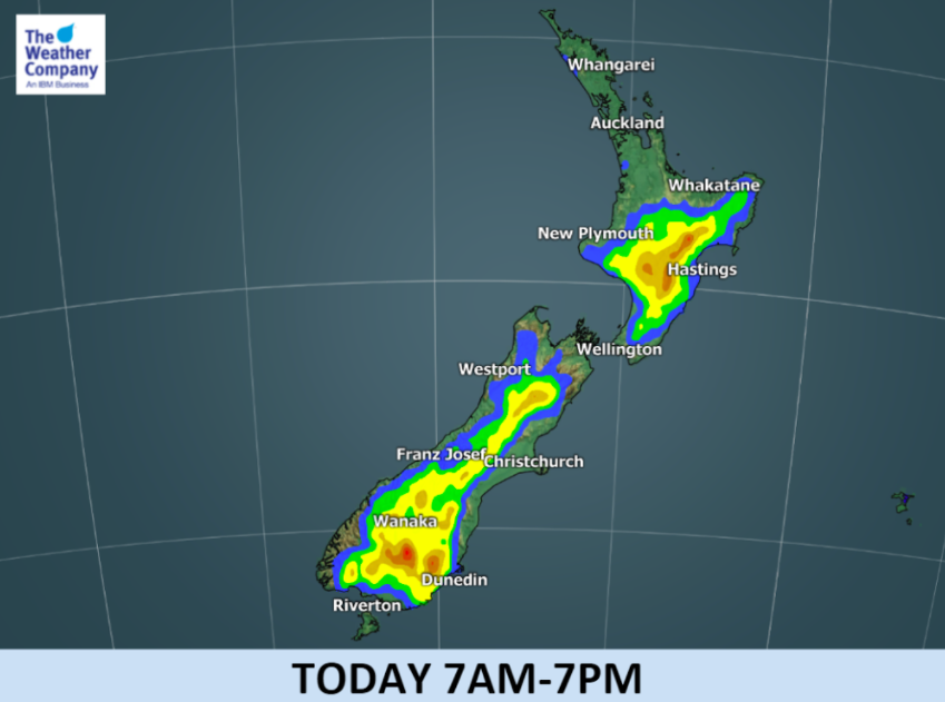
Thunderstorms flare up in Otago and Central North Island, severe thunderstorms poss. (2xMaps)
26/11/2017 2:15am

> From the WeatherWatch archives
Updated 3:15pm: Daytime heating plus converging winds have helped create significant downpours and thunderstorms around Otago and Central Plateau this afternoon and they are still developing and growing.
There is a chance thunderstorms may become severe across both inland Otago and the Central North Island / Hawke’s Bay Ranges areas from now (3pm) until early evening.
This set up is likely to repeat itself daily for the next several days. More details on Monday about that.

- “When thunder roars – stay indoors!”

The heatwave through Central Otago continues but increased cloud today will see daytime highs down several degrees on where they were a few days ago – in saying that, they remain several degrees above average for November.
Sunday’s weather highlights:
- New Zealand is still under the influence of a large high pressure system – in fact two, on either side of the country.
- Daytime downpours in interior regions in the North Island on Sunday and around the ranges of inland Otago and South Canterbury may include isolated but severe thunderstorms – this increases the risk of localised heavy rainfall and wind gusts, also hail.
- Located between these two high pressures to the east and west lies converging winds (winds from opposite directions that meet) and they will help produce clouds which will be dominant for the next few days.
- There will be little change in the maximum temperature pattern, with over 8 C higher than usual over interior areas in the South Island and at least 3 C higher in coastal areas except the northernmost regions – Auckland and Northland will be relatively closer to normal thanks to the sea breeze.


– Graphics by The Weather Company (An IBM Business & an official WeatherWatch.co.nz business partner)
– WeatherWatch.co.nz
Comments
Before you add a new comment, take note this story was published on 26 Nov 2017.


Add new comment
Derek on 25/11/2017 8:24pm
Live in Whangarei and would love some of the higher temp and sun others are getting. here it is dismal grey cloud and cool with the wind, not very good for ones temperament .
Maybe in the not too distant future we mays see some change with a few clear blue skies.
Thank you for the great job you do and for being people friendly.
Reply