
> From the WeatherWatch archives
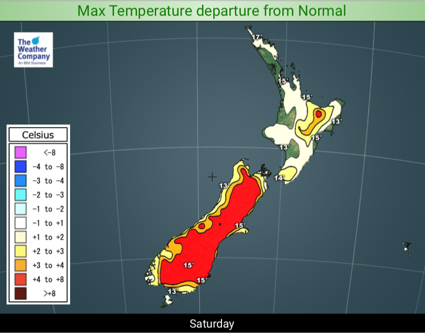
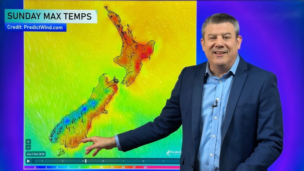
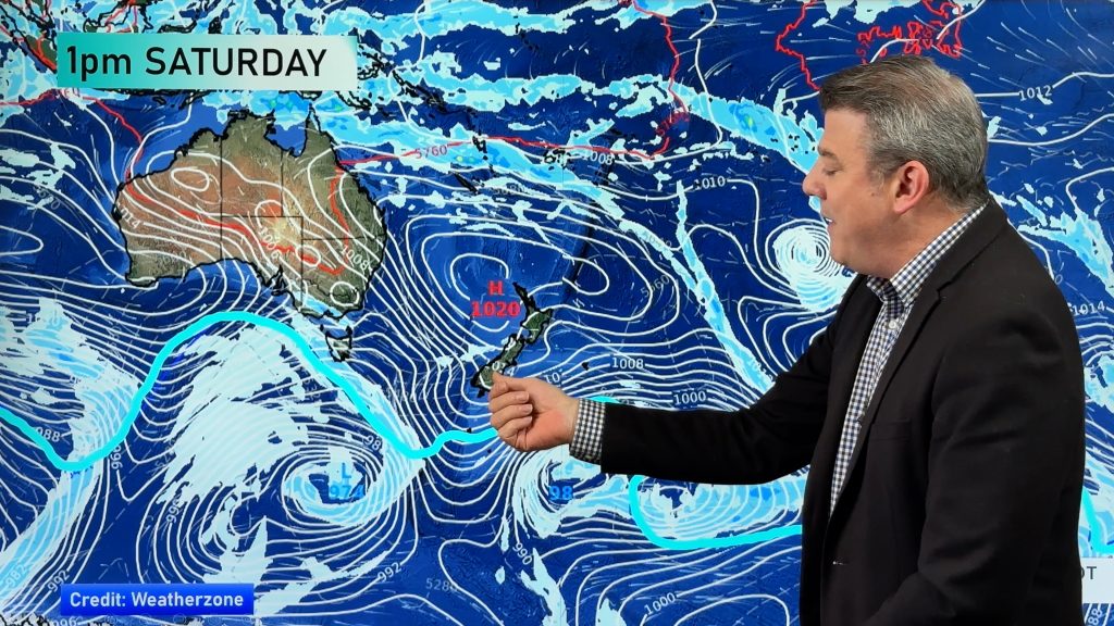
August ends on Saturday with a big high rolling in and September starts on Sunday with high pressure, light winds and a warmer than average afternoon for most places.
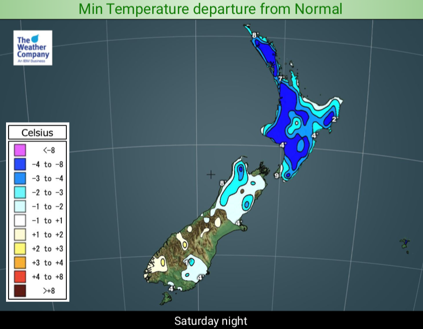
A large high is coming in this weekend and will bring cold nights to begin with but increasingly warmer weather by day. The warm weather peaks next week when sub-tropical northerlies pulled down by this large high, as it slowly departs, moves down across NZ.
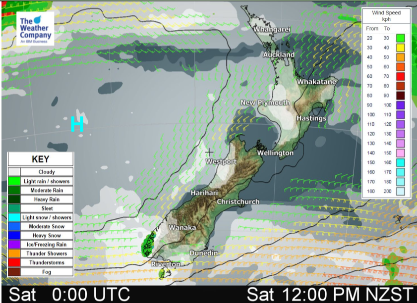
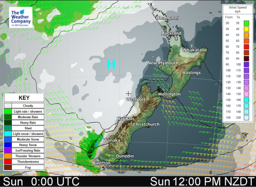
This weekend looks settled and dry almost everywhere with warmer than average afternoons and fairly cool nights – but when we take a look with the close up lens we can see a few areas worth focusing on.
- Anticyclonic gloom in the west. This is low cloud trapped under high pressure and can make for a bit of a cloudy day (or cloudy moments) with little wind to blow it away or break it up and make for more sunny spells. See the maps below to see where the cloudy areas will most likely be.
- Showers. Saturday: We may see a few early showers 1) in Northland, 2) a couple of isolated ones north of Mahia Peninsula to Gisborne and 3) The south west corner of both main islands may see an isolated shower. Sunday: Just a few showers in 1) Fiordland and 2) maybe the Far North. Some snow possible high up in the Fiordland Ranges.
- Cold nights / Frost risk. Friday night/Saturday morning looks coolest in the South Island, Saturday night/Sunday morning in the North Island. A chance of some light well inland frosts.
- Southern Ocean gales. A storm well south of NZ may see strong NW winds in coastal areas on Sunday, around Southland or perhaps further south and more so around Stewart Island and coastal Fiordland. Remote places but us Kiwis like getting out and about!
Otherwise it’s a settled, sunny and dry weekend – have a great one, New Zealand!


– WeatherWatch.co.nz
Comments
Before you add a new comment, take note this story was published on 30 Aug 2019.


Add new comment