Sunday’s national forecast – A quiet morning may turn to a loud afternoon
1/12/2018 3:00pm

> From the WeatherWatch archives
What was a large low in the Tasman Sea will today entirely fall apart but the left over moisture will remain and combined with a warmer than average day across over two thirds of New Zealand we expect some big cloud build ups and afternoon downpours with thunderstorms – some possibly severe.
Both islands kick off today with nor’east breezes, mainly in coastal areas. Inland winds will be much lighter allowing big cloud build ups. The nor’easter will help push the right conditions inland to fuel downpours too.
So while many start of dry or fairly dry with drizzle patches and perhaps light showers or (even rain around eastern BOP and East Cape) the afternoon and evening may end with loud thunderstorms inland and rain heavy enough to caused localised flash flooding.
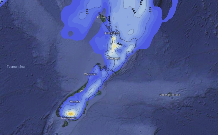
Most main centres are outside the thunderstorm risk but South Auckland and Hamilton are within in it, especially Hamilton/Waikato main centres.

 – Sunday afternoon’s thunderstorm risk (highest risk in orange and pale yellow shading, low/some risk in blue and pale blue). Data, as always, courtesy of the US Government.
– WeatherWatch.co.nz
Comments
Before you add a new comment, take note this story was published on 1 Dec 2018.


Add new comment