> From the WeatherWatch archives
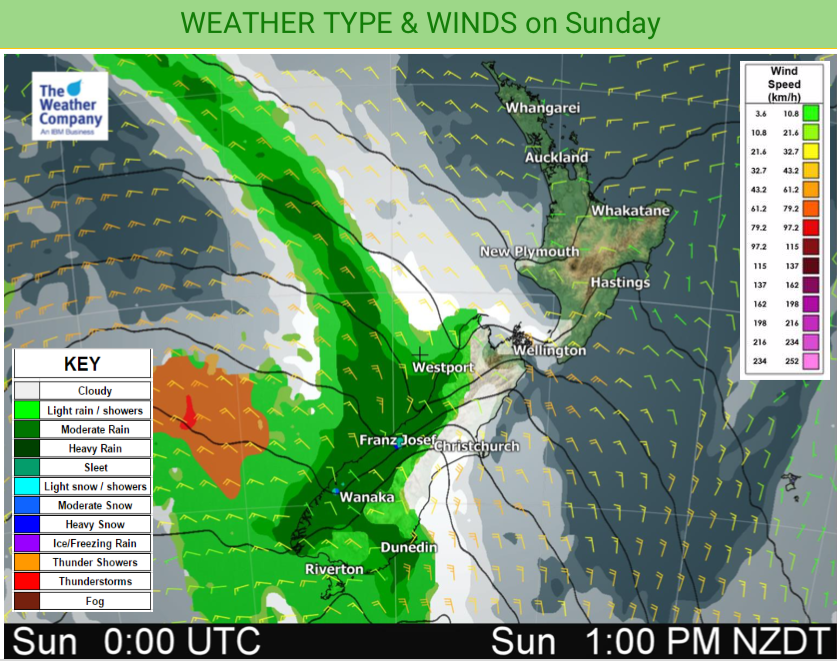
We have some severe weather in the forecast today, mostly in the form of heavy rain moving slowly up the West Coast.
Winds will also be strong through the Southern Alps and Cook Strait with gales at times.
However Sunday is also a warmer day for the North Island and sunnier too for some places that have had a gloomy couple of days in the west. Winds will still be blowing from the west but now tilting more north west which is warmer and often sunnier than a sou’wester is for western districts.
It will be sunniest and hottest in the east and inland of both islands today. Hawke’s Bay looks to be the hottest region today. Some rain will spillover into eastern Otago and Southland for a time though, with cloud also spilling over Canterbury from the West Coast.
Highs: Above average almost everywhere: 14 to 26

– WeatherWatch.co.nz
Comments
Before you add a new comment, take note this story was published on 26 Oct 2019.


Add new comment